

Dateline – October 26, 2013
I’ve been to the Trinity River Greenbelt Riverbend Preserve before—or at least I thought I had. Let me explain.
I visited this fantastic spot in far south Dallas County for the first time just a little over a year ago, and posted a writeup about the trip here: Exploring Lock and Dam Number 4.
That first visit is easily one of my most favorite. The vast natural area combined with the 100 year old ruins of Lock and Dam Number 4 made that trip especially memorable.
When I planned the first trip I utilized the Dallas County Open Spaces website for guidance. At the time the Open Spaces page for Riverbend only referenced Mapsco page 90, section A and B for the park boundaries. As you can see in the image below, it might be natural to interpret the light green as extent of the Riverbend Preserve.
That was my assumption last year, and I still had every reason to believe it was still true on my latest visit. Because of this we were more than a little surprised to be approached by an employee of the actual land owner just a few minutes after we arrived.
The fellow we spoke with was a nice guy, and after some discussion, it was determined that no one was quite sure where the actual park boundaries were. Because of this, there was no objection to us continuing with the hike as we had planned. We headed on into the woods with a promise that we would research the situation further afterwards. At his suggestion, phone numbers were exchanged in case we ran into any difficulties in the woods. Like I said, he was a nice guy.
Lock and Dam Number 4 was again the impetus for this expedition. I had a group of people with me who were interesting in seeing it for the first time. For their sake I was glad we were able to salvage the trip.
The walk in is extraordinary with exception views of the riverside bottomlands, small lakes and ponds, and the surrounding countryside. Much wildlife calls this place home.
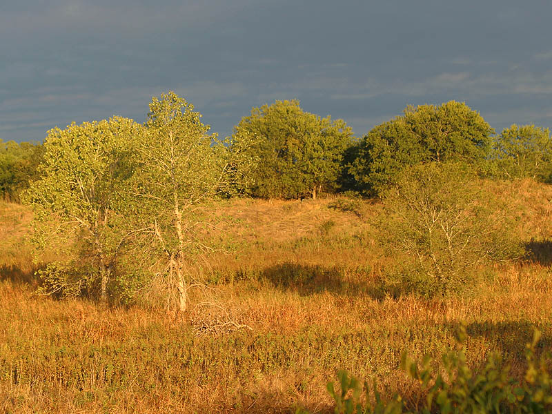
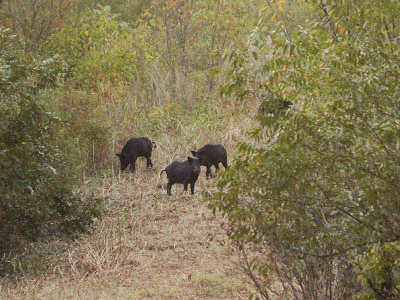
Again we followed the levee down from Mallory Bridge Road just as we did last year. Almost immdeiately we encountered a small sounder of Feral Hogs. The hogs were busy foraging and in this preoccuppied state it took them several minutes to notice us. When they finally did, the entire group beat a hasty retreat down the side of the levee and into the bottomland woods near the river.
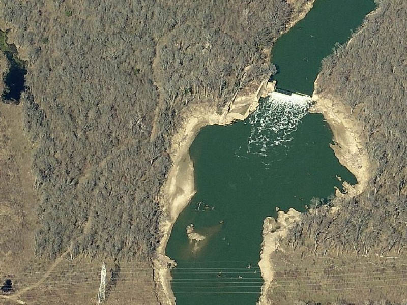
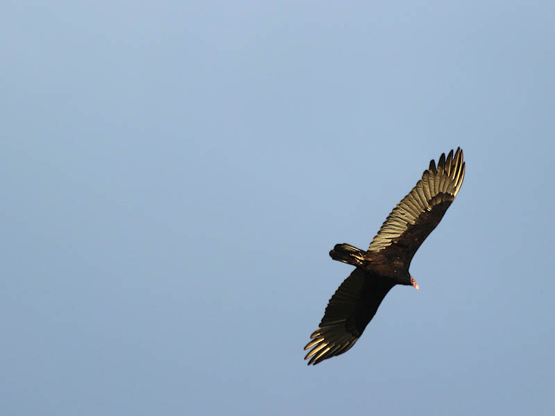
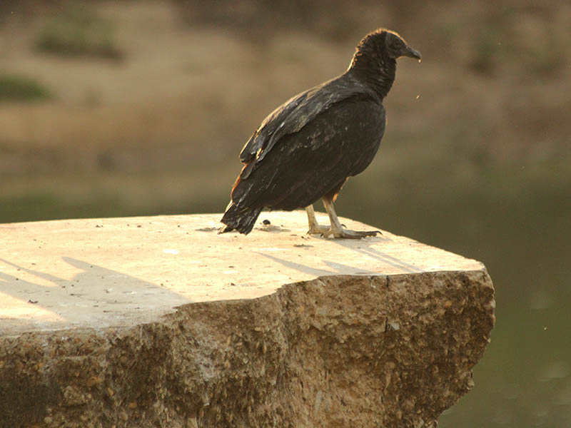
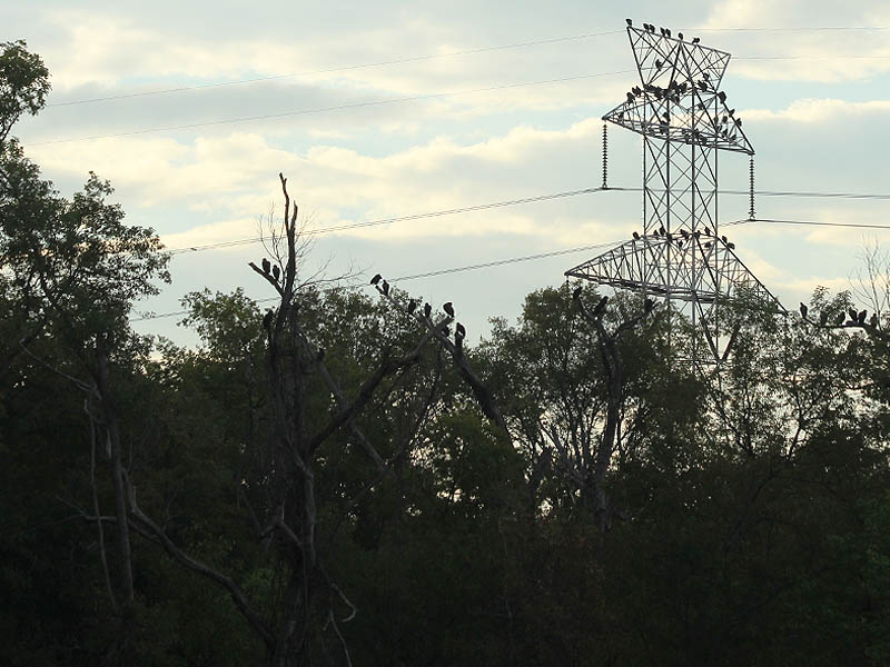
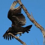
We arrived at Lock and Dam Number 4 a short two mile hike later. A large Black Vulture roost greeted us as we emerged from the woods. Dozens of the big black birds were congregating on the lock and more had taken up station on nearby transmissions towers and trees.
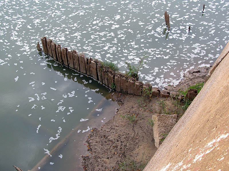
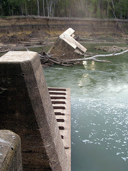
As we began to explore the lock and dam, we discovered that conditions have changed slightly since last year’s visit. Most notably, the water level is a little lower and some new aspects of the lock and dam have been exposed.
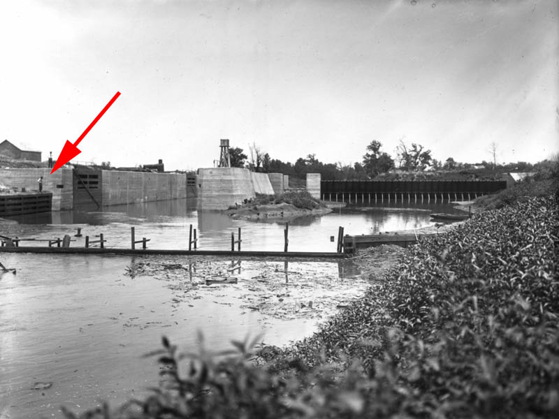
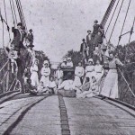
Downriver a large wooden framework was beached on a sandbar. This was not here last year—or at least it was not visible above water. When it comes to objects in the Trinity River there are always a number of possible explanations for where they came from. But, I think in all likelihood, this wooden structure is associated with the Lock and Dam. Surely it is what is left of the structure the man is standing on at the far left of this historic photograph:
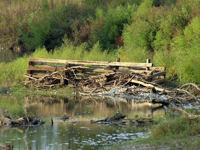
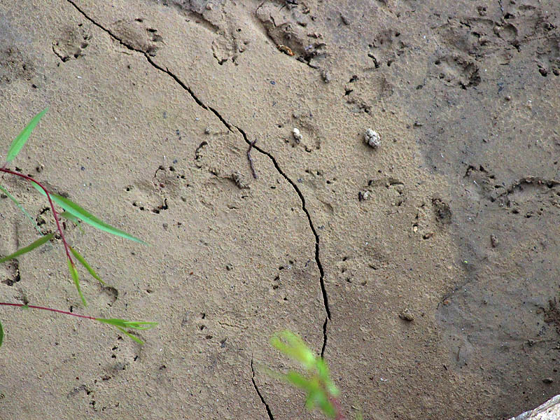
The low water conditions also gave us a better look at other aspects of the lock and dam. Certain parts of the structure that were underwater last year were now exposed and visible. Indications of wildlife activity abounded on some of the newly available mud flats.
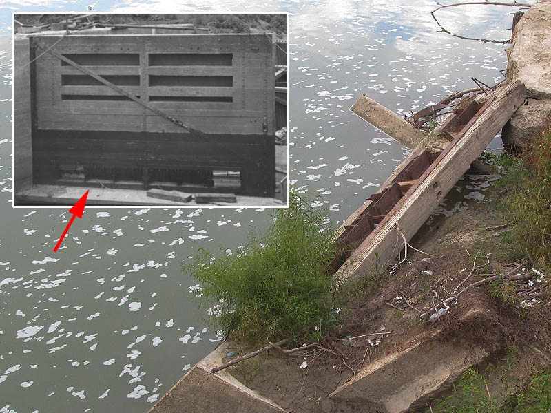
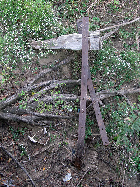
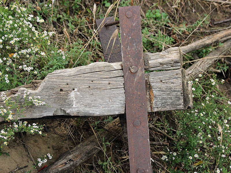
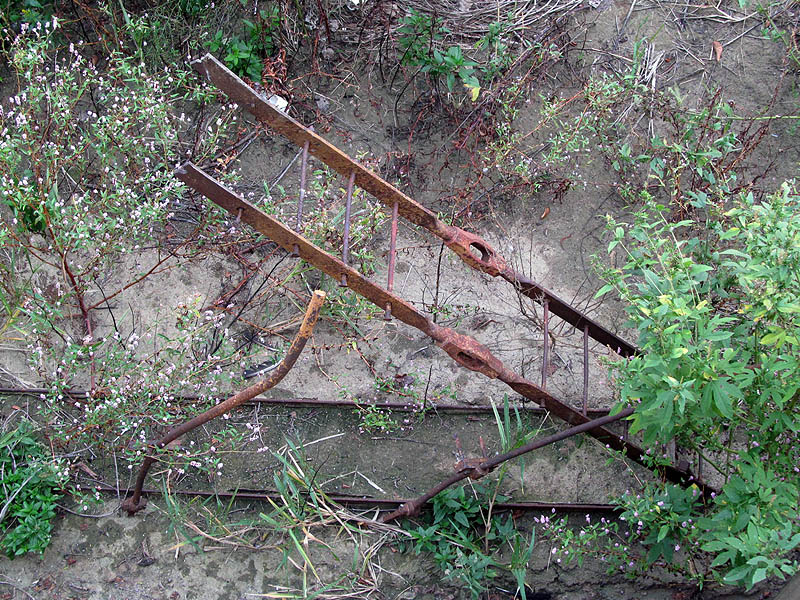
We also took the time to have a closer look at the remnants of the lock gates. Over the intervening 100 years most of the wood that made up the gates has rotted away, but the iron straps that held them all together still remain.
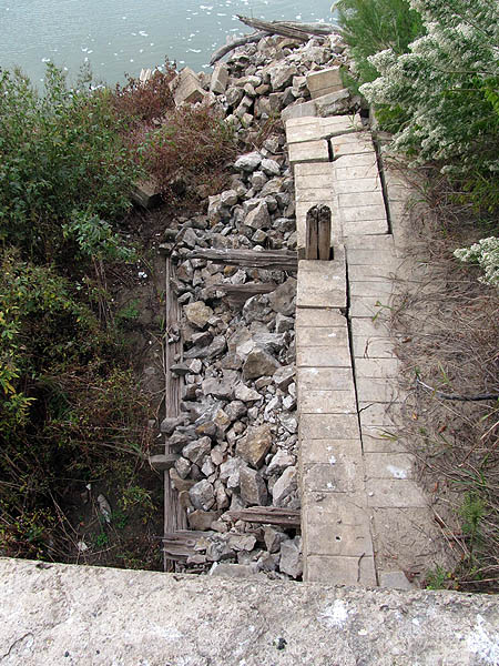
The dam itself is in a sorry state, though not much worse that last year. One section of the dam is completely missing, washed away by an angry Trinity river. The east side anchor is dislodged and tilting. The river may soon claim this piece of the structure as well.
For an added twist this year we decided to make our way back to the cars following a route through the trees down near the river. There appears to be two sets of trails under the canopy. One runs just inside the base of the levee, and the other mirrors the twist and turns of the river just above its banks. We tried them both at various times, and found that both trails were heavily overgrown in places. They do not see a lot of use these days from the looks of things.
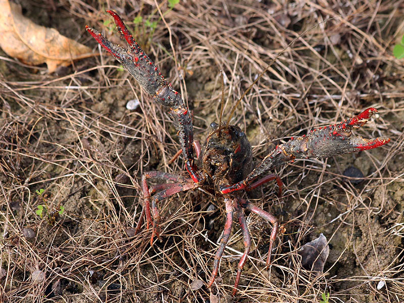
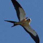
During this part of the hike we spooked a number of Swamp Rabbits, the Eastern Cottontail’s larger semi-aquatic relative. And as we neared the end of our hike we encountered this ornery fellow. A Red Swamp Crayfish blocking our path as if to demand we pay a toll for passage.
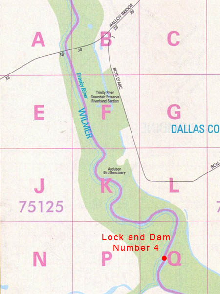
Back at home, I began to take another look at the park boundary situation as promised. I soon found that the Open Spaces web site now included a more comprehenisve map with the description of each of its nature preserves, Riverbend included. Since last year the Open Spaces webpage for the Trinity River Greenbelt Riverbend Preserve has been updated to include a map that more accurately describes the park’s boundaries.
I used that map to annotate a aerial photograph of the area to show the park boundaries as I understand them to be now. As you can see in the map below, the path we followed (green) was entirely on private property. I used the Dallas County Apprasial District’s website to verify the property lines.
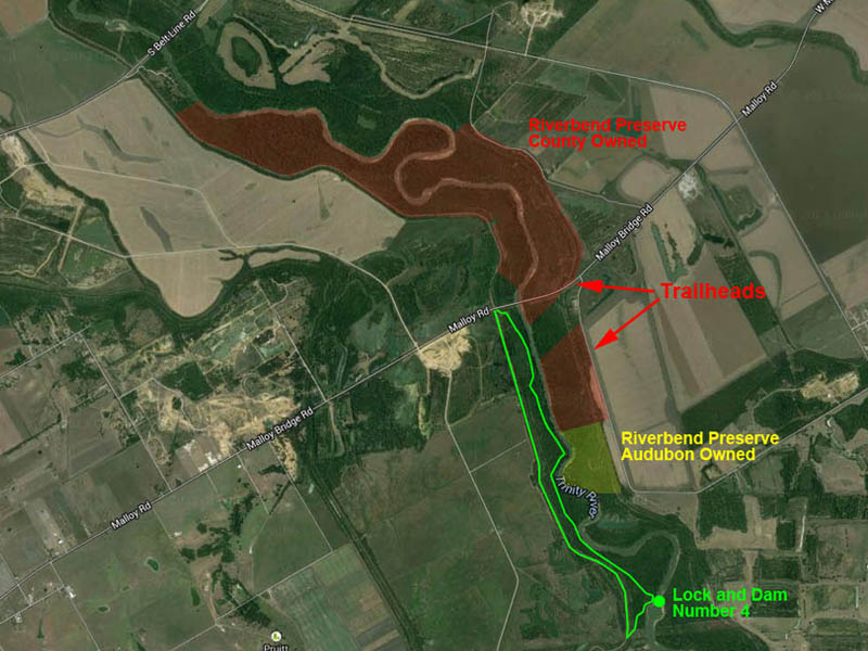
This website also revealed some interesting information about the preserve itself. All of the Riverbend Preserve is made up of land owned by Dallas County (highlighted in red), except roughly the southern eighth. This part of the preserve is owned by the Audubon Society (highlighted in yellow). I’m not sure what the implications of this ownership are, but it does much to explain the labeling of the property in Mapsco as an “Audobon Bird Sanctuary.” I have spoken with several folks involved with Audubon, and no one was aware this bird sanctuary existed. Strange.
Looking at the map I see plenty of interesting things to investigate north of Malloy Bridge Road. Reason for a return next year, perhaps?

Great photos and writeup! Love the otter tracks in the mud and all the vultures.
So I went to the Belt Line bridge this past memorial day weekend. unfortunately what I’ve found is that both the north and south trailheads (dirt roads) are gated and posted no trespassing! Are you aware of any issues with this?