

I made my first trip to Wise County way back in the early 1980’s. A hastily arranged camping trip led a small group of us up to this, the far northwest corner of the metroplex. Traveling along US 380 from Denton to Decatur, and then north on FM 730, we arrived at the LBJ National Grasslands early on a hot summer afternoon.
I was a teenager in the 80’s and this trip was one of my first forays into independence, unsupervised by adults as it was. I can remember being very excited, and I can remember noticing so many things about rural Texas that were different from the more urban environment I was used to.
To be clear… this camping trip happened a loooong time ago. For a little context, I distinctly recall that The Fixx’s monster hit, “Deeper and Deeper,” started getting air time on the radio that very day. We heard it for the first time as we arrived at our campsite, and it became the defacto theme song of the weekend. Ah, the 80’s. Easily the best decade evar. Give the song a listen. I have it linked below. Perhaps it will become the theme song of this article as well…
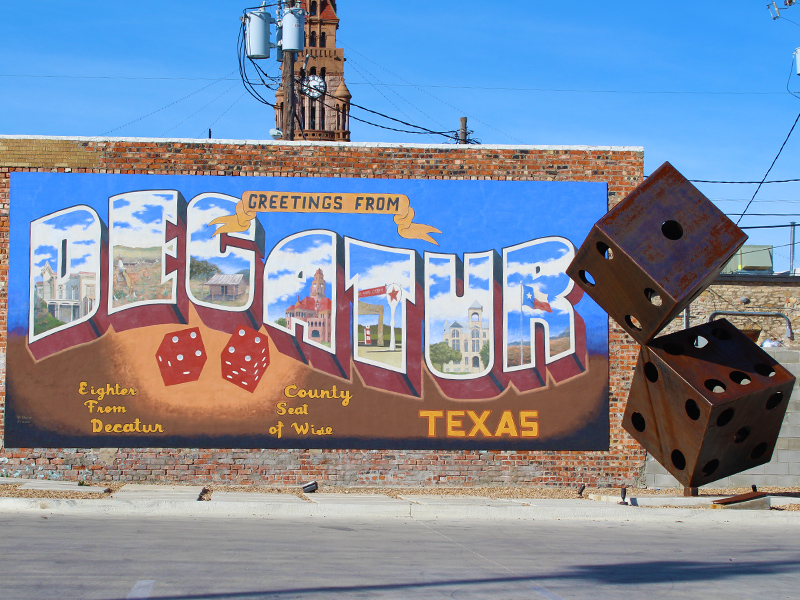
In addition to the spectacularly excellent new wave music, a couple of other things about the trip struck me back then. Like I noted earlier, the drive to the grasslands takes you through Decatur, Texas—the seat of Wise County—and Decatur is an interesting and homey place. There are buildings and houses in this town that just scream historical significance with their location and/or iconic architecture.

The people in Wise County are friendly, too. When you drive through a town square or down one of the less-traveled back roads, the folks you pass will wave to you from behind the wheel of their pickups. That kind of thing just doesn’t happen in Dallas/Fort Worth proper (or if it does, it’s kinda oogie).
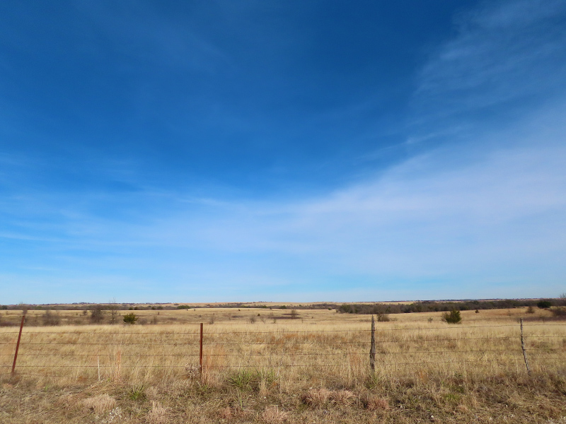
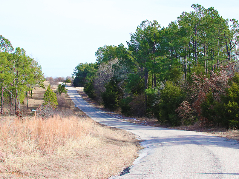
The other notable thing about Wise County is that you can pick one of the back country roads at random, drive it, and be treated to absolutely stunning vistas–sometime for as far as the eye can see. If you love Texas and the Texas countryside, Wise County was made for you.
Those things that have not changed much in the intervening years–to that I can attest. You see, a few weeks ago I had the opportunity to venture into Wise County again. It was my first extended visit in many years, and I decided to make the most of it. Planning ahead just a little bit, my daughter and I compiled a list of the significant historical buildings and markers in the county, so that we could stop by as many of them as possible as we drove through.
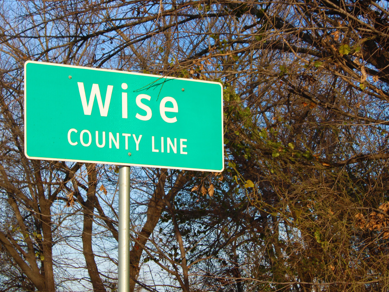
These days crossing over the Wise County line is a little like taking a trip back in time. The clock seems to tick little slower in Wise County. There may be no place on Earth that can escape the determined march of progress, but this little Texas County is giving it the old college try. Much of Decatur and the surrounding country side is essentially the same as I remember it from those halcyon days back in the 1980s.
Undoubtably, things in Wise County have changed to one degree or the other over the years, but progress comes at a glacial pace compared to what we experience here in Dallas/Fort Worth proper. In the Metroplex a new high-rise can go up, or a new subdivision can be developed in just the blink of an eye.
After this—my latest visit to Wise County—I have many new pictures to share. I can’t help but wish that I also had some photos from back in the day, but I don’t. Taking pictures just wasn’t my thing back then. Plus, any picture I could come up with from the early 80’s is liable to include me wearing red parachute pants, and nobody wants to see that.
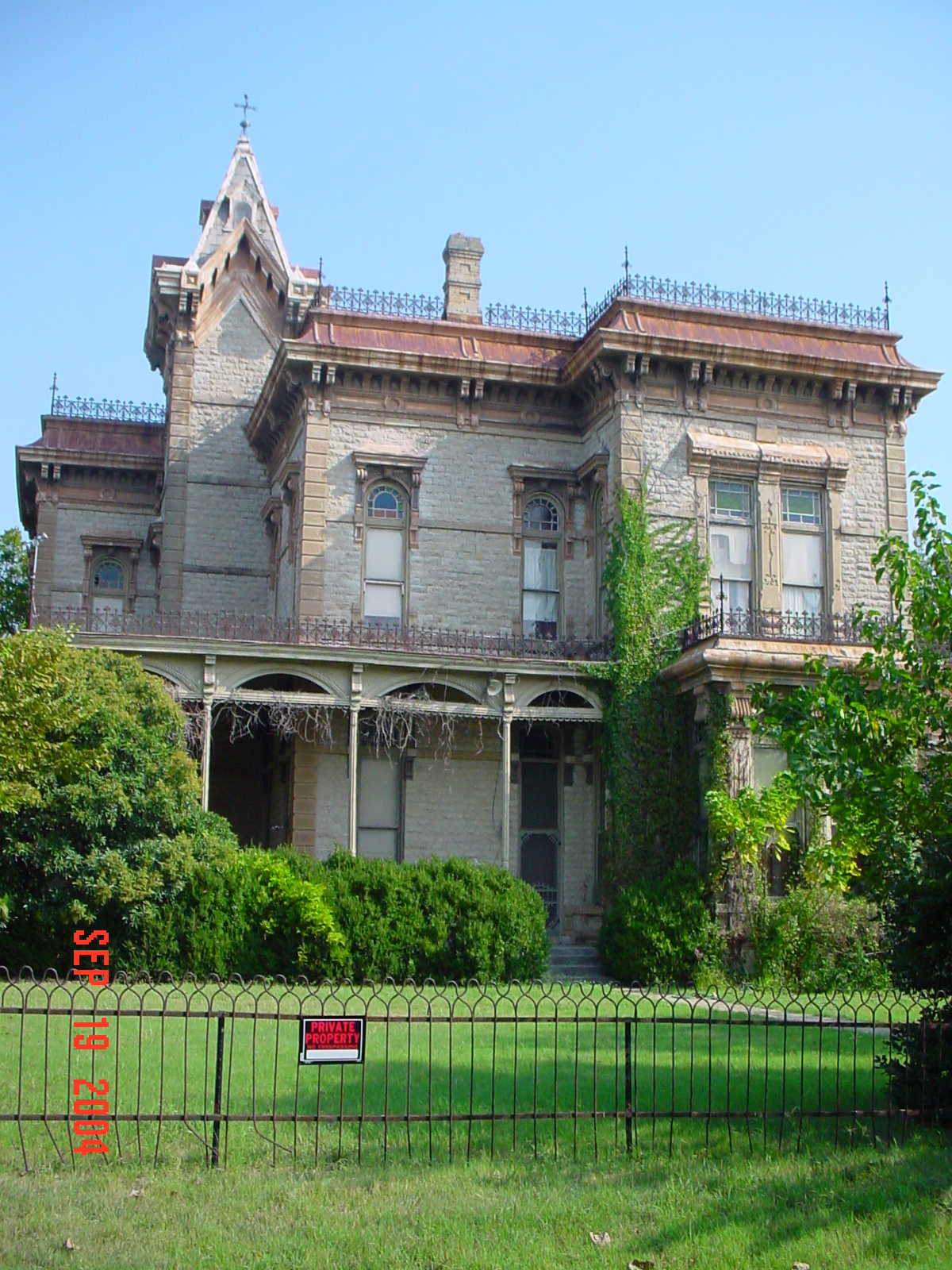
I do, however, have a few shots taken in 2004 and 2005, from around the time I first started introducing my kids to the area. It’s possible these fifteen year old pictures may suffice in helping make my point about the rate of change. We will see. I’ll include a few of them in this article as we go along.
The first stop for my daughter and I was on the high plains just outside the Decatur city limits on US 380. There a pair of historical markers sit side by side just off the busy highway.
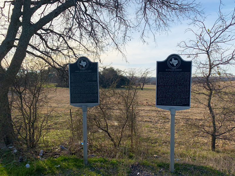
A pair of historical markers located on the outskirts or Decatur, Texas
One marker notes the location a hideout used by the famous old west outlaws, Frank and Jesse James. The other marks a land grant owned by Dr. William Renshaw, the first doctor to settle permanently in Wise County. The text for each marker is included below…
Jesse and Frank James
Famous western frontier outlaws, who had many Texas hideouts along a line from the Rio Grande to the Red River. The camps – extending into Missouri, their home state – were used for hiding stolen horses until posses could be thrown off the trail. The campsites were sometimes known to scattered settlers, who feared or befriended the bandits.Also, friendly with the James brothers (and also operating sometimes in Texas) were fellow Missouri outlaws, Cole Younger and “Bandit Queen” Belle Starr.
This was an era of widespread lawlessness in Texas. Billy the Kid roamed into West Texas. The Daltons, John Wesley Hardin, Cullen Baker, Bill Longley, Sam Bass and many others found it easy to kill and rob and then hid in wild areas where they were beyond the reach of local officers, and food was plentiful.
After reconstruction ended in 1874, Texas Rangers were reorganized, to restore respect for the law. Given special powers, in 1889-90 they arrested 579 wanted men (including 76 alleged murders). Jesse James and some other notorious badmen by then were dead. Frank, reformed, worked as a salesman in Dallas, Paris, and other Texas towns.
Dr. William Renshaw
Born in Illinois, William Renshaw studied medicine and set up practice in Sparta, Tennessee. His wife Sarah received from the Mexican government a grant of land in Texas, where her father Samuel Worthington lost his life in a colonization attempt in 1828. Dr. Renshaw traveled to Texas in 1853 to locate this headright, which encompassed many acres of Wise County north of this marker site. Dr. Renshaw returned to Sparta and served two terms in the Tennessee Legislature before moving his family to Texas in 1859.The first doctor to settle permanently in Wise County, Dr. Renshaw was often away from home for long periods, with a practice extending from Denton to Jacksboro. The Renshaws organized one of the county’s earliest schools, taught by J. D. White, for their own and neighbor children. After the Civil War, the family moved to Decatur, where Dr. Renshaw and his son Lute opened a drugstore. They were devout Baptists and supported Decatur Baptist College.
Dr. Renshaw died in 1887 and was buried at Oak Lawn Cemetery in Decatur. As his 10 children married, each received a portion of the Worthington survey. Two family members still own part of the property. A number of descendants became doctors.
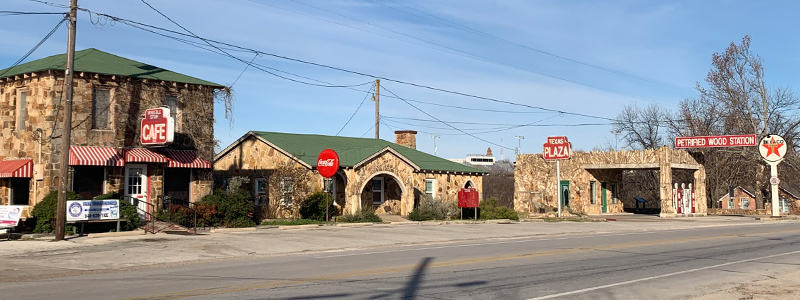
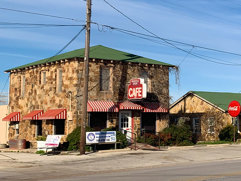
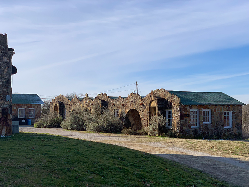
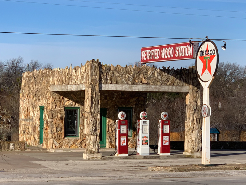
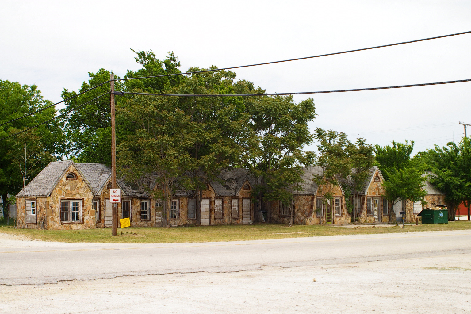
Next on our agenda was a quick tour of Decatur proper. There were several markers and historical buildings in the city that we wanted to see. At the top of our list was the famous Petrified Wood Station, Whistle Stop Cafe, and Texas Plaza located along BUS 81 on the east side of town.
This intriguing site hails back to the heyday of the American love affair with travel by automobile. The tourist complex is an early example of motor lodging concept–the great grandfather of the motor hotel or motel.
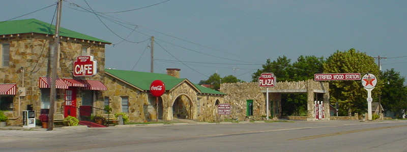
I understand that the cafe is very popular with the locals. We wouldn’t have time to give it a try on this visit, but I think we might make a return trip very soon just for that very reason!
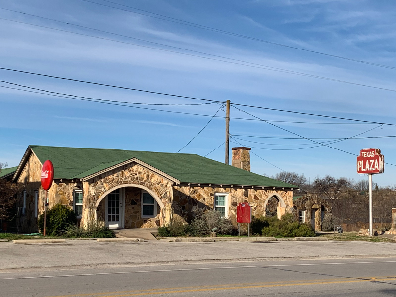

Looking back toward the plaza…
There is a historical marker on this site as well. Here is how it reads…
Texas Tourist Camp Complex
Local businessman E. F. Boydston (1888-1945) purchased this site, a former feed lot, in 1927 for $400. Recognizing a potential business opportunity in offering services to the traveling public, he built a wooden shed and gas station in 1927. Travelers were allowed to build campfires during overnight stays, and by 1931 Boydston added three wooden cabins with garages to the camp complex. The buildings later were faced with rock, and more cabins and garages were added in 1935. The original wooden gas station was covered with petrified wood in 1935 when the highway was widened and remained in operation by the Boydston family until 1988.The Texas Lunchroom, a one-room frame building, was built in 1929. Renamed the Texas Cafe in 1935 and faced with stone to match other buildings in the complex, it was enlarged to provide second-floor living quarters. Popular with local high school and college students, as well as families and the traveling public, it was closed in the 1960s after a highway bypass built west of town diverted traffic from this area. The cafe reopened in 1993. One of the few intact examples of tourist camps built throughout Texas in the mid-20th century, this property is significant for its association with the early development of automobile tourism.
A cold front had rolled through the area a day or two earlier, leaving much of the county with a light dusting of snow. Most of it had melted by the time we arrived, but some snow and ice lingered on north faces and in the shadows. You may notice it in some of our pictures if you have a sharp eye!
If you look back to the north from the Petrified Gas Station, you might notice the historic Old Waggoner Mansion off in the distance. That will be our next stop–just a short hop, skip, and jump down the road.
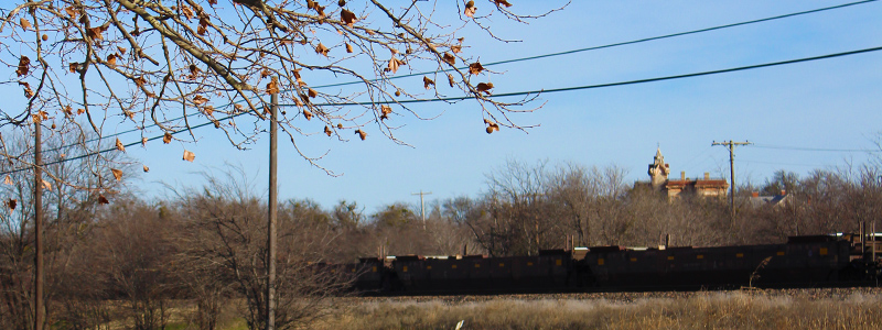
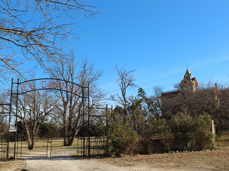
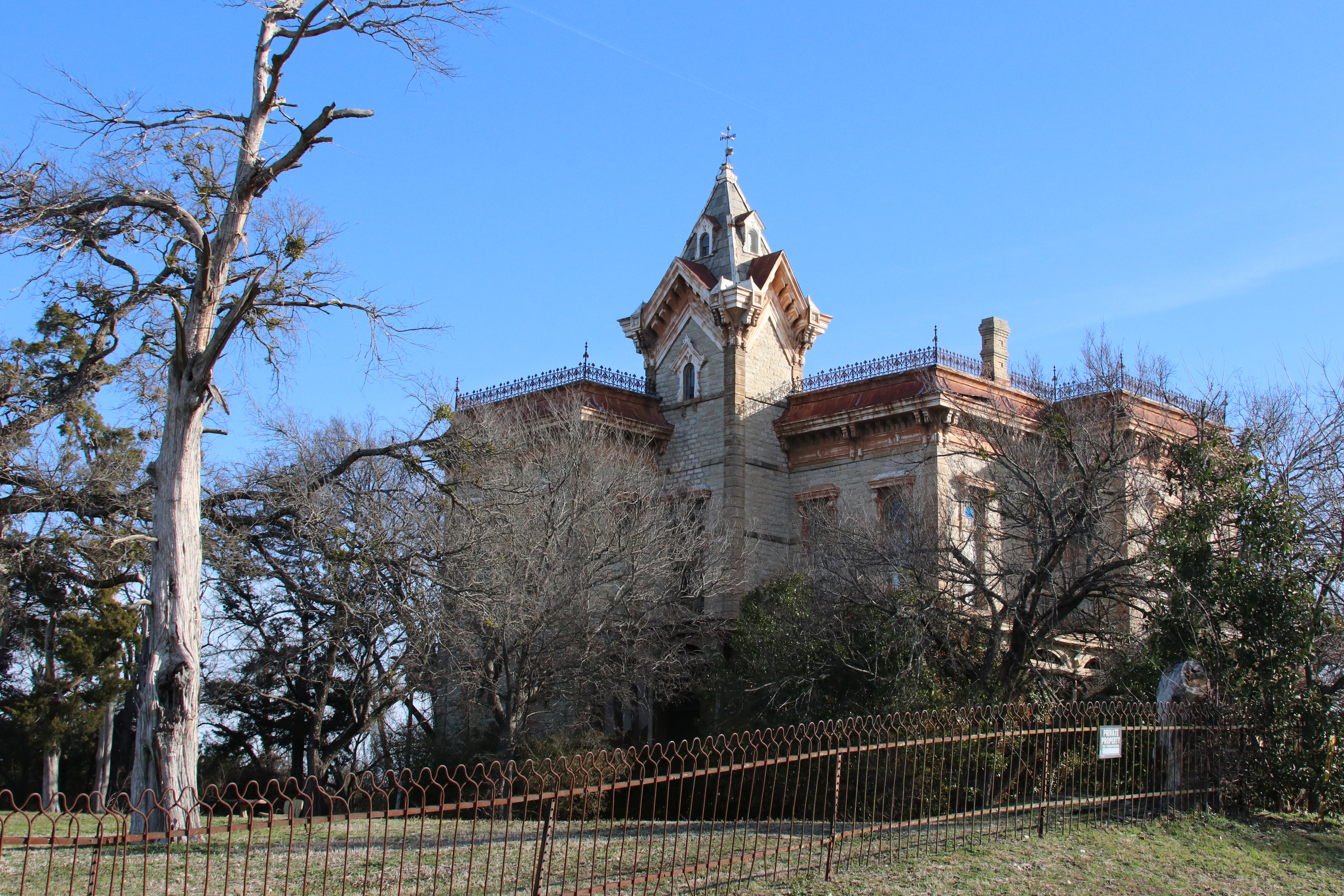
The Old Waggoner Mansion is stationed on the terminus of a roughhewn and lonely dead-end road. The property comes complete with an undeniable and thoroughly authentic haunted-house vibe. A shiver will run down your spine when you see it in person.
This old building is the one that made the biggest impression on me when I first saw it back in the 1980’s. I can verify absolutely, that this place has changed very little in the last 35 years.
Surely a house like this has significant historic importance, but details about the residence have been excruciatingly difficult to dig up. Here is some of what I could find online…
The Waggoner Mansion
– from the Texas Historical Commission web site
The Waggoner Mansion or El Castille, as it is sometimes called, is an excellent example of Texas’ finest Victorian masonry architecture. Built in 1883, the house has retained approximately ninety percent of its original craftsmanship and material. This percentage far exceeds most large Victorian homes of this nature that remain in such a good state of repair in Texas, and consequently by all means this home can be classified as being “authentic”. Both the exterior and interior walls are of solid poriferous limestone construction. Although the exterior is in a good state of repair, it is in need of preventive maintenance such as painting and minor material replacement. Exterior cornice detailing, opening trims and porch construction are combinations of wood and metal. Grill work on the exterior around the roof is original, although the grill work around the porches of the house has been added after 1941.
The house contains a large basement, sixteen rooms and six and one-half bathrooms. There are two bedrooms downstairs and four upstairs. The interior of the house is in very good condition. The intricate woodwork, hardware and finishes are well maintained and only portions of some ceilings and upper walls are in need of any repair. There are many distinguishing features of the home. They include 18 ft. ceiling heights downstairs, 16 ft. ceiling heights upstairs, intricately carved door mouldings on all the interior doors with a Texas “LoneStar” motif carried throughout the house, brass hinges, doorknobs and miscellaneous hardware, frescoed ceilings in a few of the rooms, stained glass transoms above all doors and windows, interior wooden shutters on all windows, eight fireplaces each with decorative tile insets, light fixtures, especially made for individual rooms and marble lavatories in all of the bathrooms. An artisan named Decker was brought from France to the Waggoner Mansion at the turn of the century to add the fresco decorations in some of the rooms. Decker signed one of the compositions in an upstairs room.
Only a few interior alterations have occurred. For example a butler’s pantry has been converted into the kitchen. The original family kitchen is now used as a family living room-den with a fireplace that had previously been walled up. The fireplace was probably sealed when the home was restored by William Thomas Waggoner in 1931.
The house was built and owned by the Waggoner family from 1883 until 1906. In 1906, the mansion and surrounding acreage was traded by W. T. Waggoner to Samuel Bellah, III for a ranch in Baylor County. It was home to the Bellah Family until after the death of Mrs. Bellah in 1929 when Mr. Bellah sold it back to the Waggoners. The mansion was purchased by Mr. and Mrs. Phil Luker in 1942. The Luker family have lived in the house since their purchase of it.
There is a separate addition to the house at the rear. Out buildings include a wooden smokehouse, storm cellar, and a more recent four car garage with stables underneath. To the northwest of the house stands one of the original bunkhouses used on the Waggoner Ranch.
This impressive masonry Victorian house was the home of the Waggoner family, prominent in the early days of ranching in Texas. In the boldness of the style and in the strength of the material the builder achieved an appropriate expression for the original owner, Daniel L. Waggoner, and the times he personified.
In the middle of the nineteenth century, Dan Waggoner drove a small herd of Longhorns into Wise County and launched a successful career that by 1870 earned him the recognition of being a “cattle king.” At the time he built this baronial mansion it was the headquarters for the distinguished Waggoner Ranch which reached into a seven county area. By 1900 this sixteen room two story house was the headquarters for this well-watered and compact ranch that spread thirty miles east and west and twenty-five miles north and south, and included over a million acres. The Waggoner Ranch supported over 60,000 head of cattle, and it was served by three separate railroad lines. Dan Waggoner died in 1904, and this house became owned by his son, William Thomas Waggoner. After oil was discovered on the ranch in 1903, development resulted in the founding of the Waggoner Refinery in 1911. The fortune which resulted from this cattle and oil base enabled the Waggoner Family to become one of the richest and most influential families in the Southwest.
In 1931, W. T. Waggoner restored the home. After the death of W. T. Waggoner in 1934, the house was sold to Mr. and Mrs. Phil Luker in 1942. The moviemakers of the 1956 film “Giant” duplicated the exterior for the movie set. Thus, the Waggoner mansion is one of the foremost and striking architectural remains of the indelible marks left by the cattle empire of Victorian Texas.
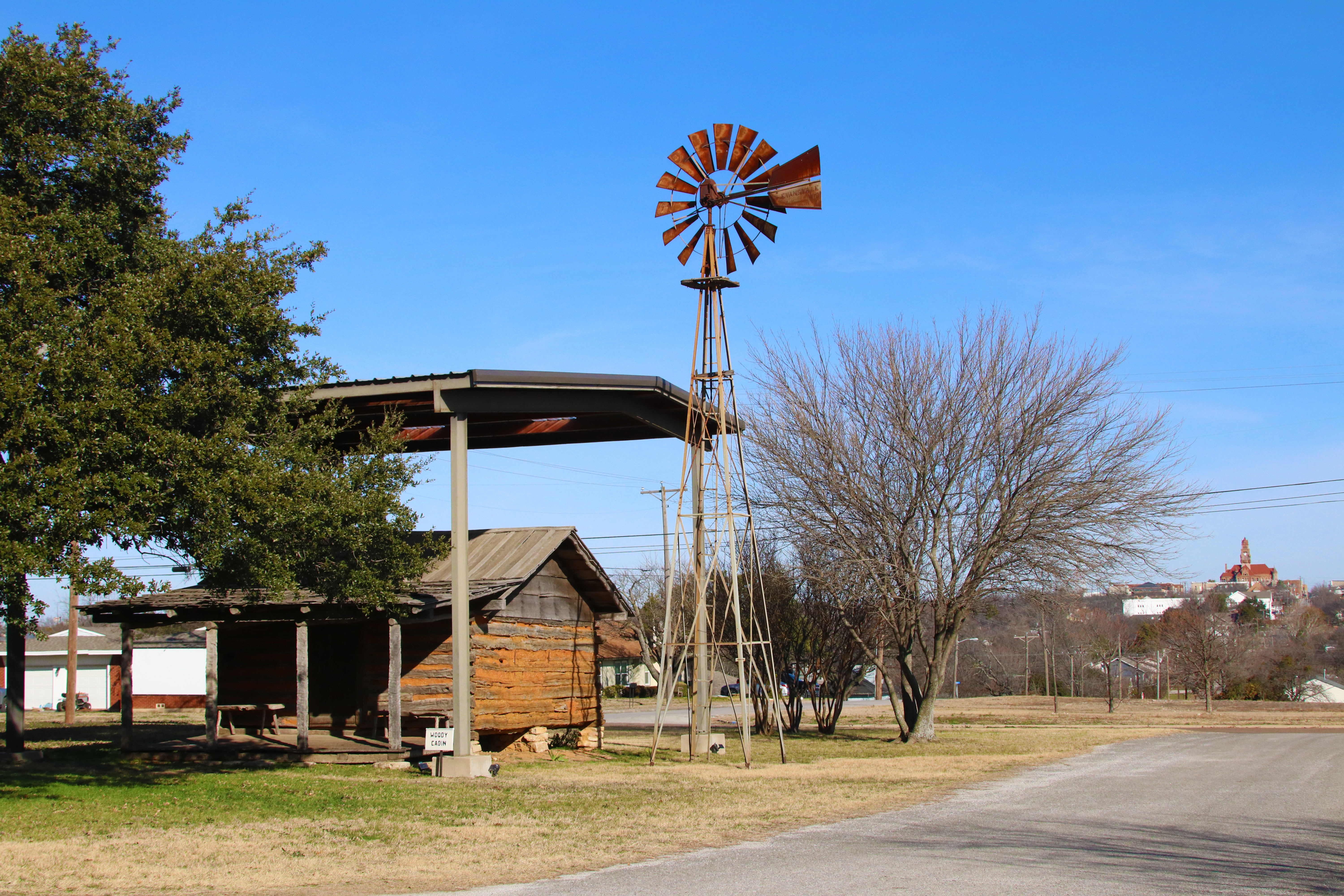
Next on the agenda was a visit to the old Decatur Baptist College building. This striking Gothic-looking building sits atop another high hill–this time on the south side of town–and now houses the Wise County Heritage Museum. Since 2006 the museum has shared these grounds with the relocated and historic Sam Woody Cabin, thought likely to be the oldest building in the county.
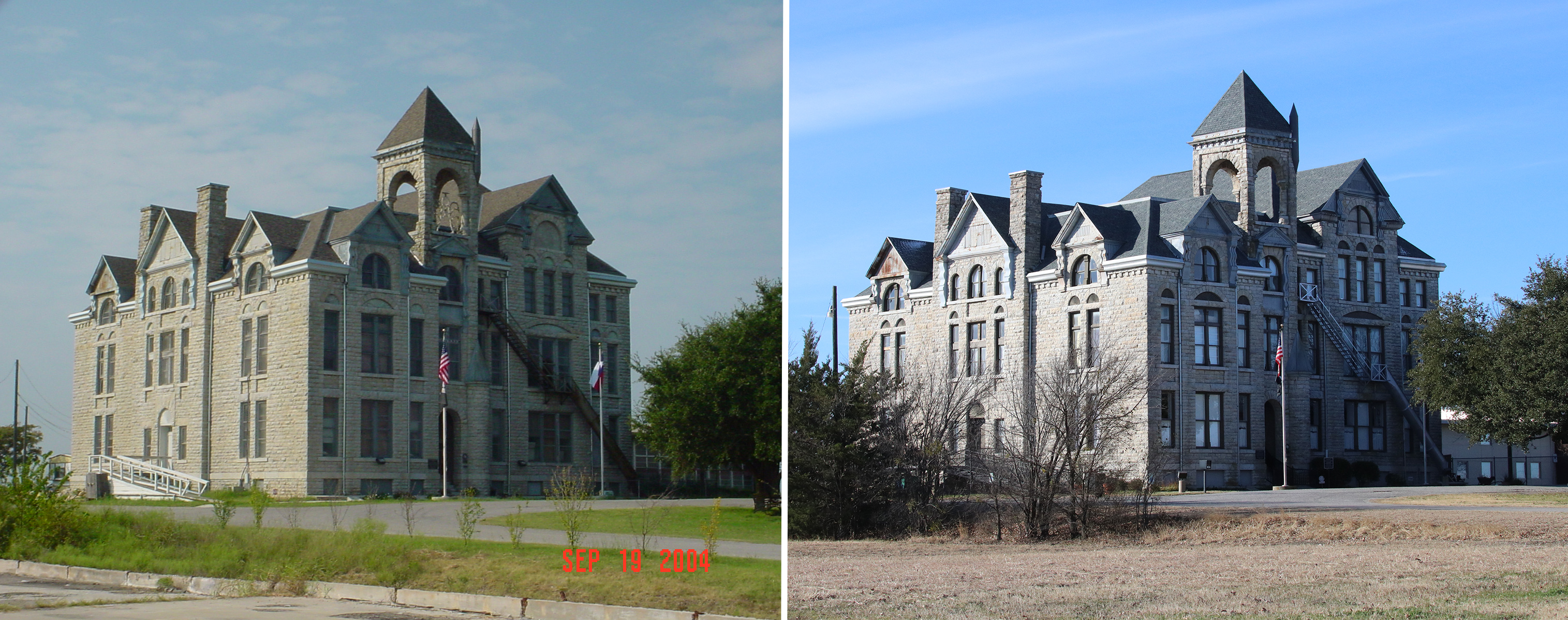

Decatur Baptist College
Decatur Baptist College was the world’s first institution to be planned (in 1898) as a junior college. This hall was built in 1892, for an earlier school. The Baptist Convention bought the property and turned it into Decatur Baptist College, through the support of 20 Wise County men who pledged $1,000 each.
The home of the world’s first junior college, the school was a preparatory school for Baylor University until it moved to Dallas in 1965. The last president of Decatur Baptist College was Dr. Otis Strickland.

Sam Woody Cabin
Tennessee pioneer Sam Woody (1826-1920) migrated to Texas in the 1840s and then brought his family to Wise County in 1854. This cabin, originally located near Deep Creek, was the first dwelling in the area. After Woody cut the logs, friends and relatives helped him erect the cabin in one day. Indians came to trade buffalo robes and moccasins for corn. The house was frequently crowded with guests because frontier travelers were never turned away. Woody guarded pioneer settlements as part of a Ranger unit and served in the Confederate army during the Civil War (1861-1865). It was recorded as a Texas Historic Landmark in 1970. The cabin was moved from its original site to the museum grounds in October 2006.
From the vantage of this historic building, there is a commanding view of much of Decatur. Looking to the north we could easily see our next stop–downtown Decatur and the old county courthouse!
As is true in so many Texas county seats, the town square in Decatur is dominated by its beautiful and historic courthouse. This impressive pink granite building was completed in 1896, and was the fourth in a succession of Wise County Court Houses. You can read more about them all here: Wise County Historical Society – Wise County Court House.
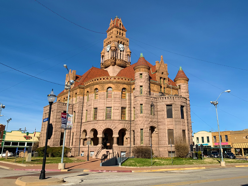
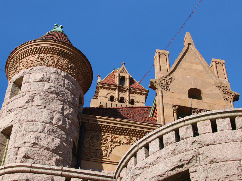
The ornate building was designed by architect, J. Riley Gordon of San Antonio


There are three historical markers on the lawn of the courthouse building. Each memorializes an early prominent citizen. The text is included below…
Charles Vernon Terrell
A leading public man in Texas, 1896-1939. Born in Wise County to early (1854) settlers. After two years at Texas A & M, read law and began practice in 1886. Served 1888-92 as Decatur City attorney; 1892-96 as county attorney; 1896-1901 and 1909-13 from Denton-Montague-Wise counties, in Texas Senate. There he sponsored act creating North Texas State University. He was state treasurer of Texas from 1921 to 1924.Appointed in 1924 to the Texas Railroad Commission (chairman 2 terms), he served during landmark years when Texas was catapulted into role of a major world energy supplier. Through regulation of oil and gas shipping, the Railroad Commission became the agency for making production rules. When East Texas in the 1930s began to produce oil in volumes such as the world had never known, and the state invoked martial law to quell strife there, Commissioner Terrell and associates pioneered in conservation without the sacrifice of industrial leadership.
After his retirement in 1939, his native county had an oil discovery at Park Springs, in 1942. The Chico field came in with larger yields in 1947.
C. V and Etta (May) Terrell were parents of Tully Vernon, John Preston, and Margaret (Mrs. F. . Ward).
Randolph Vesey
Respected Negro citizen and homeowner. Champion pioneer fiddler, popular at Forts Belknap, Griffin and Richardson and over county. Once when he was an Indian captive, held in Kansas, Texans sent ponies to ransom him. He is buried in Oak Lawn, Decatur.Born in Georgia. He served during the Civil War as body servant and voluntary battle aide to General W. L. Cabel of the Confederate army. Vesey’s courage and loyalty were typical. Hundreds of slaves went to war with masters. Many operated farms and ranches of soldiers away at war, producing cotton and food for the Confederacy. Others did work for hire, with wages supporting the master’s family. On patrol duty they protected homes from Indians, bandits, outlaws.
During War years, 1861-1865, some 30,000 to 50,000 Negros – free and slaves – aided Confederate armies. They served with the Nitre and Mining Bureau and departments of medicine, engineers, quartermaster general, ordnance and commissary general. They built fortifications on coasts from Brownsville, Texas, to Norfolk, Virginia, and at inland points. Many were army teamsters, wheelwrights, blacksmiths, butchers, shoemakers, cooks, and nurses. Texas and other states later provided land grants and pensions for army.
Captain George W. Stevens
Captain George W. Stevens was born in Lowndes County, Alabama, on July 12, 1830. He lived in Arkansas briefly where he married Martha McDonald in 1852. The couple moved to the Wise County area in 1855 and Stevens became a leader in the efforts to defend the frontier from raids by Native American tribes. Stevens served in Company “C” of the “Frontier Cavalry,” or the 46th Cavalry Regiment.Stevens’ first wife, Martha, died in 1858 and Stevens married Nancy Buchanan. During the 1860s, Stevens served as Wise County Sheriff. By the 1870s, most frontier warfare with Native Americans ended due to their resettlements on reservations. During this time, the Texas Rangers slowly transitioned from military to law enforcement.
In 1874, with the close of the post-Civil War Reconstruction era, Stevens was designated the captain of Company “B” of the Texas Rangers’ “Frontier Battalion.” The battalion, comprised of 75 members mostly from Wise County, engaged in numerous battles across the frontier in an effort to end the war for the frontier. At one such battle at Buffalo Springs in Clay County, Capt. Stevens was severely wounded. By the end of 1874, Stevens resigned as captain and again sought office as county sheriff. Lt. Ira Long, also a Wise County native, was promoted to command Company “B.” Long was previously selected by battalion commander, Major John B. Jones, to lead Jones’ “escort.”
In 1878, Sheriff Stevens and a local posse joined the pursuit of the famed Sam Bass outlaw gang. One member of the gang was killed in a gunfight at Salt Creek just west of Cottondale as the rest of the gang escaped. The gang was caught again a month later in Round Rock. Stevens died April 11, 1893 and is buried in Flat Rock Cemetery located five miles outside Decatur.
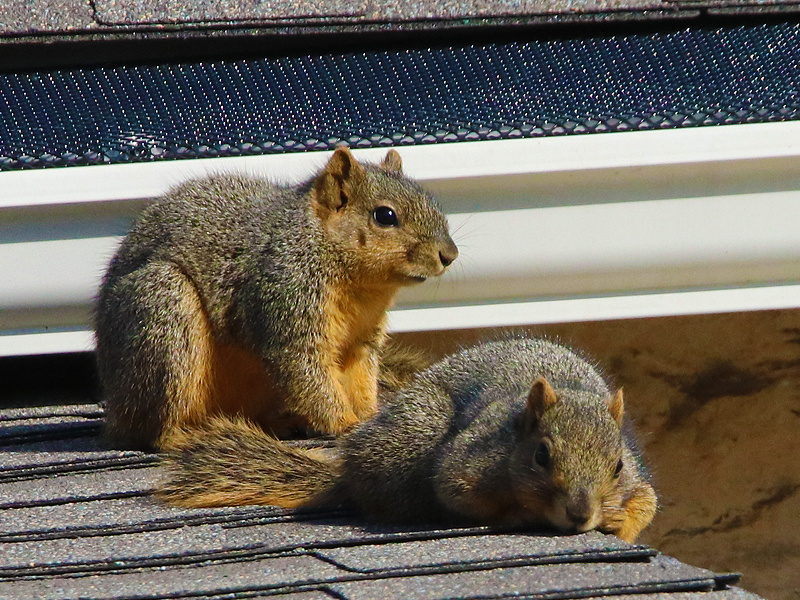
Just down the road from the courthouse is the Old Stone Prison. This building did double duty–providing housing for law enforcement officials, and also serving as a jail. We arrived just in time for a prison break, as two desperado Fox Squirrels tried to make a getaway through a small hole in the roof. It seems the Old Stone Prison may have an rodent infestation.
Old Stone Prison
This was the first stone house in Decatur, erected by prison labor about 1859. The main house was the residence of the sheriff or deputy, while the basement was used as the jail. Meals were sent down a dumb-waiter located outside the east end of the house.The County sold the property in 1888 to A. H. Whitehead. It was used as the city water works building until 1938. Then it was kept as a private residence until 1967 when it was purchased by the Wise County Historical Society as a museum. It was recorded as a Texas Historic Landmark in 1968. It is not open to the public.
We hit our last Decatur historical marker on the way out of town. This one memorialized something know as the Gose Trees–a unique hedge row of Bosi D’arc trees near downtown.

Bois D’arc trees are also referred to as Osage Orange trees. Many people in North Texas know them as the tree that produces the big green and knobby Horse Apple fruit. In the days before barbed-wire, Texas pioneers would sometimes plant hedges of Bois D’arc trees to create and enforce property boundaries. These tough trees grow a thick system of thorny branches that hang low to the ground. That characteristic is what made these trees so appropriate for use as hedge-fencing.
The Gose Trees marker is on the site of the remnant of one such hedge. The trees here were planted to help protect the log cabin of Stephen M. Gose. A picture of the site follows, as does the text from the marker…
Gose Trees
Remnant of bois d’arc hedge which encircled the log cabin of Stephen M. Gose (1824-77), early justice of the peace, blacksmith, and leader of Methodist church, who came to Texas from Missouri in 1859. The spiny trees, planted 1861, served as a barrier against prowling Indians.
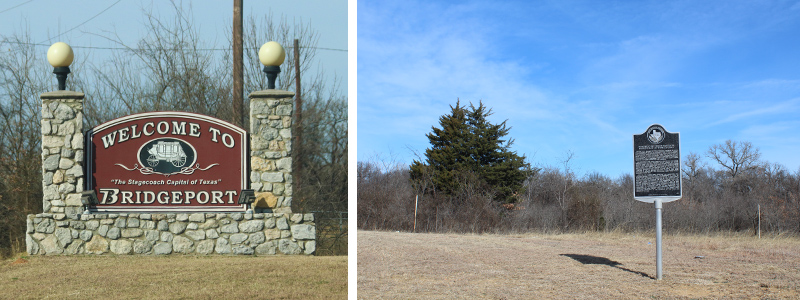
Leaving Decatur, we now headed west on US 380 for the 10 mile drive to the city of Bridgeport. Our first stop here was going to be at a historical marker just on the outskirts of town. The sign commemorates the Republic of Texas’ Sante Fe Expedition as the party of 321 explorers moved through this part of Wise County in July of 1841. An interesting bit of history, for sure. And one I wasn’t previously aware of.
Republic of Texas’ Santa Fe Expedition in Wise County
In June 1841, Republic of Texas President Mirabeau B. Lamar commissioned an effort to increase Texas’ political, military and commercial influence in Santa Fe, then a part of Mexico claimed by the Republic of Texas. A party of 321 men set out from north of Austin on Brushy Creek (present-day Round Rock) on June 19. This group included merchants, engineers, infantrymen and a newsman. They took with them a large quantity of trade goods and one cannon.The expedition had great difficulty penetrating the dense undergrowth of the western Cross Timbers of north central Texas. Three miles southeast of here, the men burned most of their tents, poles and other gear in order to move faster. They then forded the West Fork of the Trinity River and crossed near this site mid-day on July 26, 1841. The men endured hardships and delays further west, and were captured in the fall before reaching Santa Fe. They were marched to Mexico City and imprisoned. Most were finally released in April 1842.
One of the guides who survived this expedition was Colonel William Hudson Hunt. On returning to Texas, he took up his surveying profession. He settled in Wise County, where on the Santa Fe Expedition he had observed the region’s ranching potential. His ranch, called Cactus Hill, now lies under the waters of Lake Bridgeport. Col. Hunt became a respected community leader and in 1859, he and others requested a rerouting of Butterfield Overland Mail Stages to the south from Cooke County to Decatur and then west to Jacksboro and on to San Francisco. The rerouting led to bridging and ferrying activities for stagecoaches and freight wagons at this Trinity River crossing, resulting in the creation of the town of Bridgeport in 1860.
Just across the highway, a group of vultures–both Turkey and Black–had gathered to perform their vital duty of cleaning up carrion wherever they find it. In this case, it was roadkill that attracted the big black birds. Together, this group had managed to drag a carcass just off the highway, where they could eat in safety, unconcerned about the dozens of cars zooming by just a few feet away.

From here, we were off to Haywood Park just a little southwest of downtown Bridgeport. The historical marker in this park records the importance of the coal mines that were a big part of the economy here–until cheap oil and gas put them out of business in the early 20th century.
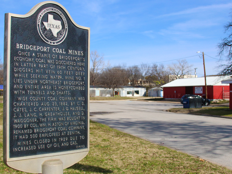
Bridgeport Coal Mines
Once a staple of Bridgeport’s economy, coal was discovered here in later part of 19th century. Diggers hit vein 60 feet deep while seeking water. Mine No. 1 lies under northeast Bridgeport, and entire area is honeycombed with tunnels and shafts.Wise County Coal Company was chartered August 23, 1882, by C. D. Cates, J. C. Carpenter, J. G. Halsell, J. J. Lang, H. Greathouse, and D. Waggoner. The firm was bought in 1900 by Colonel William H. Aston of Virginia. Renamed Bridgeport Coal Company, it had 500 employees at Zenith.
Mines closed in 1929 due to increased use of oil and gas.
Next we headed out of town on FM 920 to a spot just west of Bridgeport. We found the historical marker we were looking for just a few miles down this lonely country road. Here on the West Fork of the Trinity River is the original location of the town of Bridgeport. An important toll bridge anchored the community in those early days.

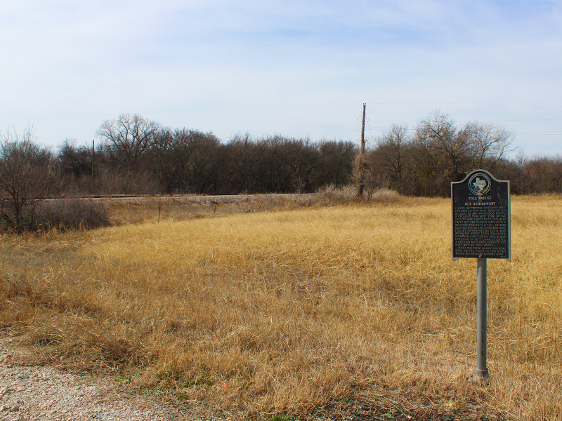
Toll Bridge and Old Bridgeport
When Butterfield Overland Mail traversed this area (1858-61) on St. Louis to San Francisco route, a crossing over West Fork of the Trinity was a necessity. Colonel W. H. Hunt on February 11, 1860, obtained a charter and built a toll bridge here (50 yards west). The Overland Mail ceased operating as Civil War began. The bridge soon collapsed. However, a settlement had begun here, and in 1873 Charles Cates, a Decatur merchant, spanned the river with an iron bridge.When the Rock Island Railroad built to this point in 1893, the town moved but retained its historic name.
Bridgeport is the second largest town in Wise county. With just around 6000 residents, Bridgeport is only a slightly smaller than Decatur. Both communities retain their small town charm. And like Decatur, Bridgeport also has a wonderful and still vibrant downtown area.
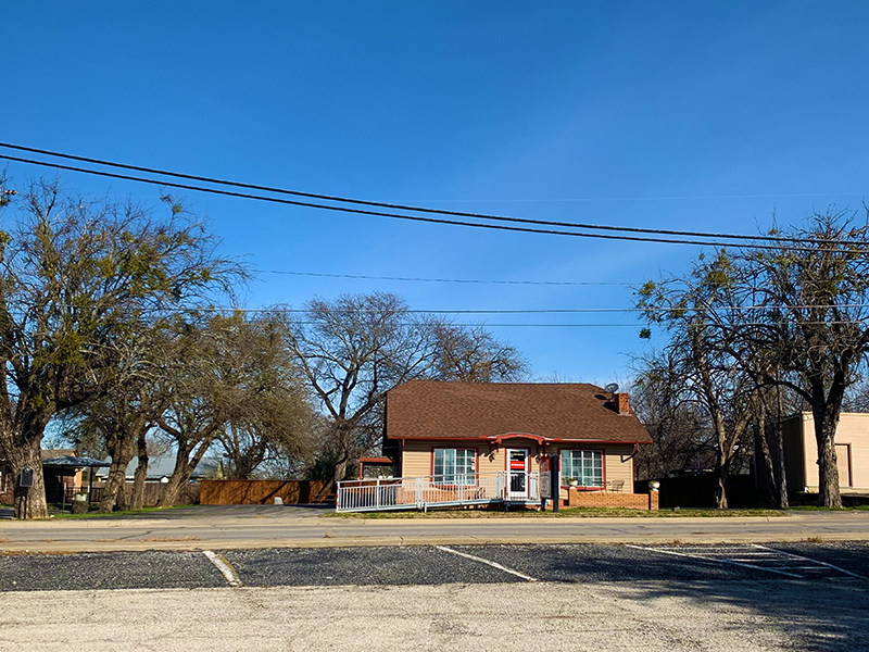
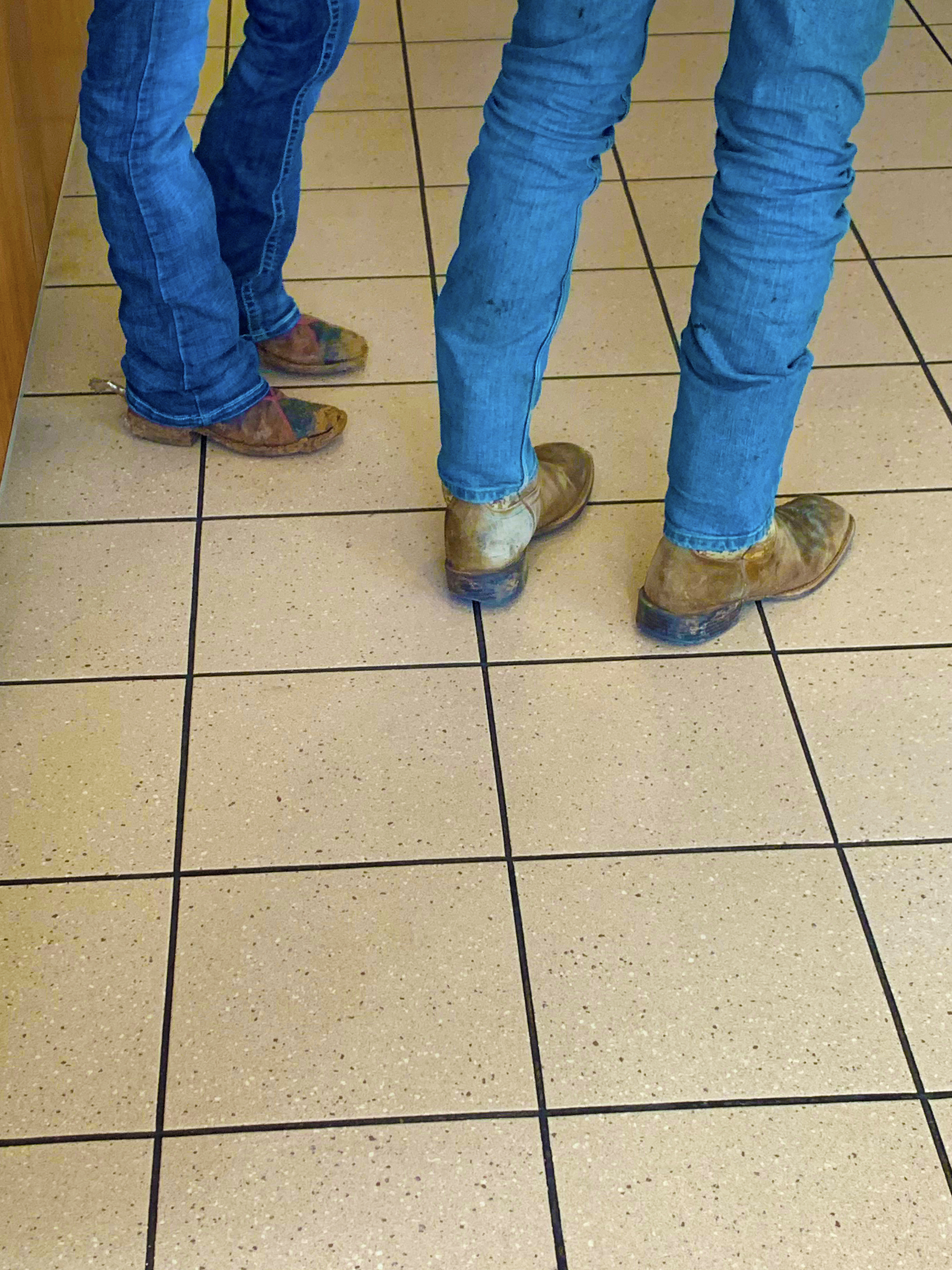
Before moving on from Bridgeport, we decided to stop for a quick lunch. We shared the quaint country restaurant with a group of real Texas cowboys–blue jeans, boots, spurs and all.
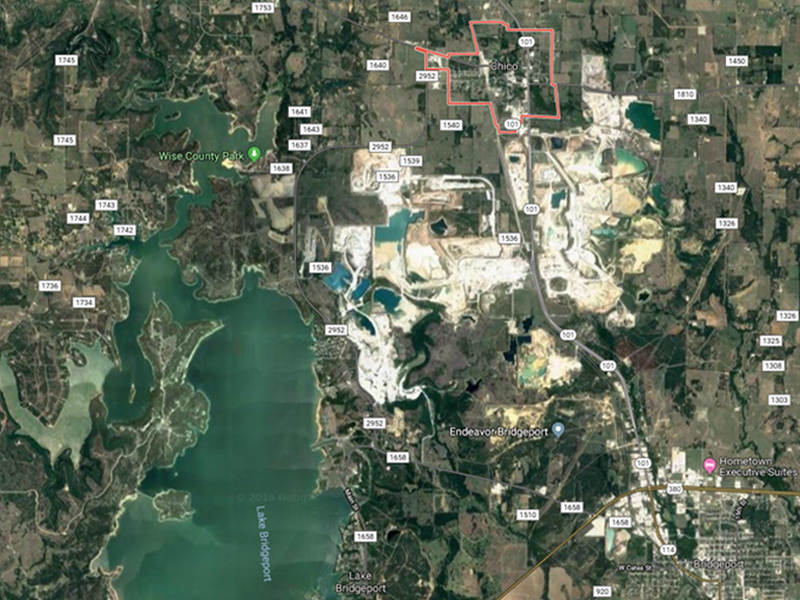
Back on the road again, our next stop was the town of Chico–The Limestone Capital of Texas. A quick look at an aerial view of Chico reveals the reason behind the nickname. Several massive limestone mining operations have left an indelible mark on the landscape. It takes a lot of limestone to build North Texas!
Traveling north along TX 101, we made a brief detour just outside the Chico city limits. A few miles down FM 1810 we found the historical marker noting the location of capture of two young children by a Comanche raiding party. You can read the fascinating details below…

Indian Captives Dot and Bianca Babb
Two of Texas history’s best-known Indian captives, 13-year-old T. A. “Dot” Babb (1852-1936) and his 9-year-old sister Bianca (1855?-1950) were stolen by Comanches from their home near here in September of 1865.While at play one day, the children were surprised by a raiding party of 35 to 40 Indians. Mrs. Babb was killed and Dot, Bianca, and Mrs. Luster (a visitor) were taken to Indian Territory (present Oklahoma). After helping Mrs. Luster escape on the way, Dot was very nearly executed, but so stoic was he in facing death that the Indians admiringly spared his life.
For the next two years Dot and Bianca lived, in different tribes, as adopted Comanches. Bianca later recalled that the Indians held a feast – with coffee, a luxury – upon her arrival and that they colored her blonde hair with charcoal and buffalo tallow.
Dot, after a winter as the squaws’ flunky, asserted his male rights and thereafter spent his time taming horses. He was taken on raids against other tribes and showed signs of becoming a fine warrior.
After two years, the children’s father ransomed them and a joyful reunion occurred. Both Dot and Bianca spoke with sympathy, however, of many Indian customs and of kind treatment during captivity.
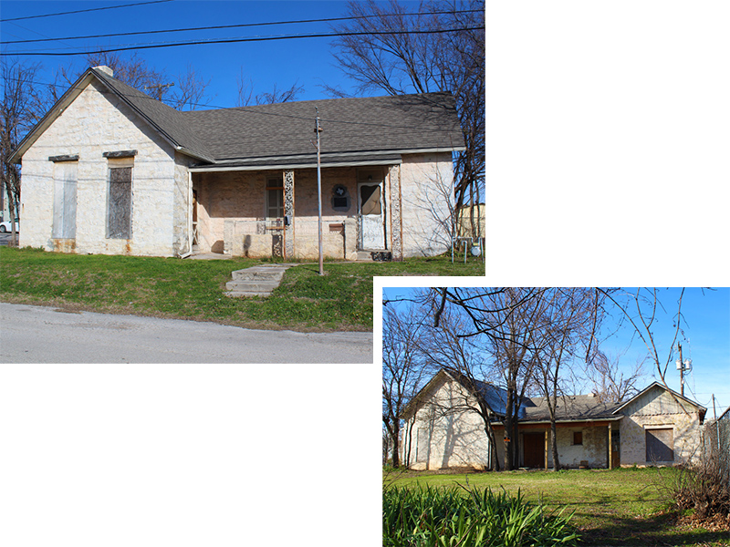
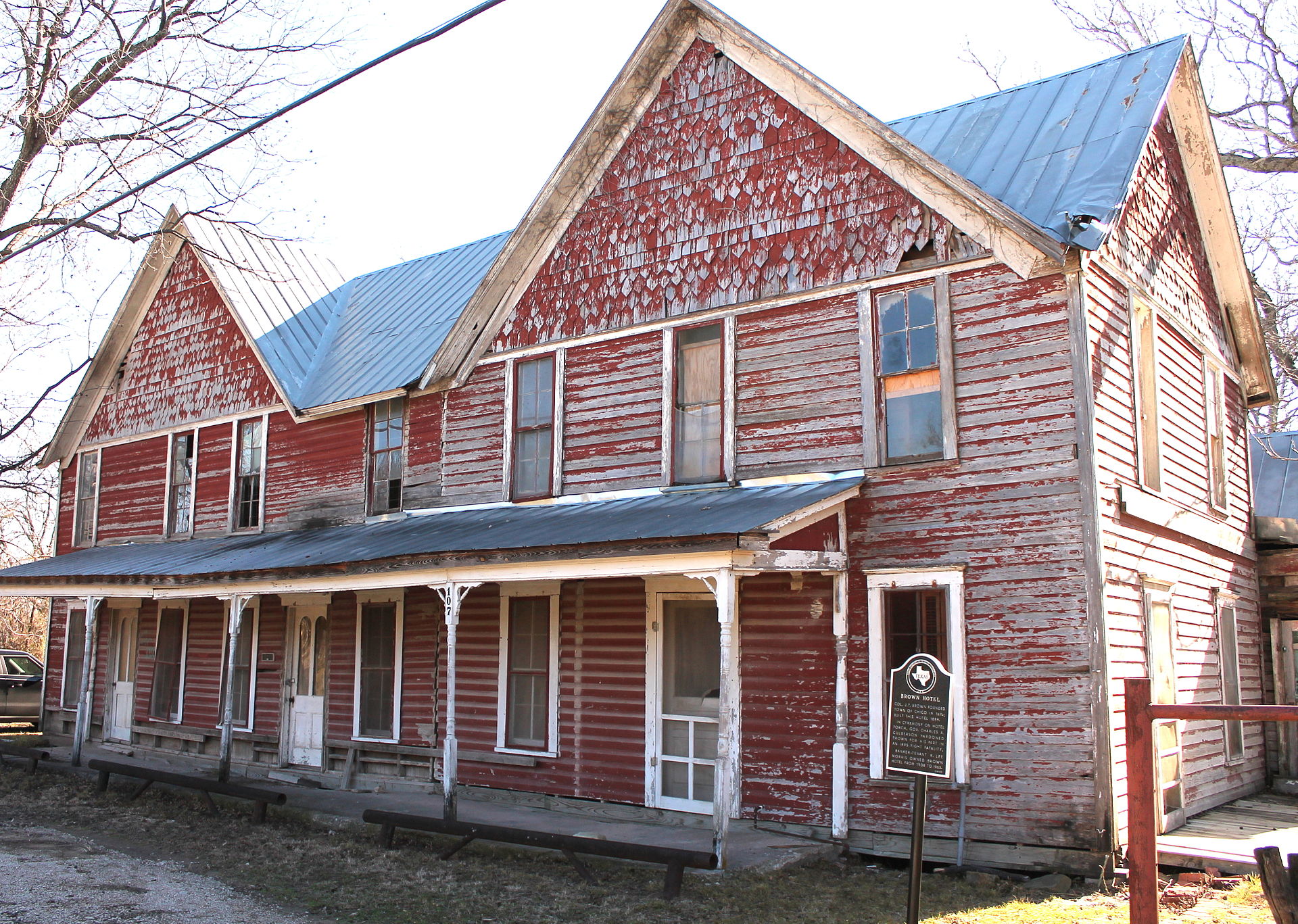
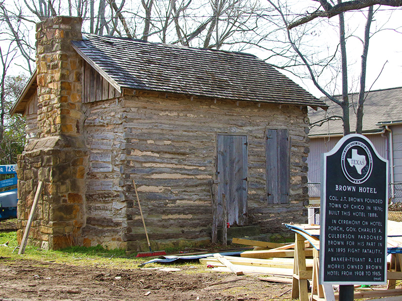
In Chico proper there were a couple of markers we wanted to have a look at. Fortunately, both sites were in close proximity to each other near the downtown area–the J.T. Brown Hotel and the Siddons-Barnes Log Cabin.
We were perhaps the most interested in seeing the hotel in person. A picture we found online indicated that the building was likely to be in very close to its original state.
This is how we expected to find the Brown Hotel – Picture from the Wise County Historical Society
We were a little shocked to find the building in a somewhat odd state of restoration. I’m going to assume that this is the very early stages of what will ultimately be a more comprehensive and fully well-considered renovation–complete with windows and doors. LOL.
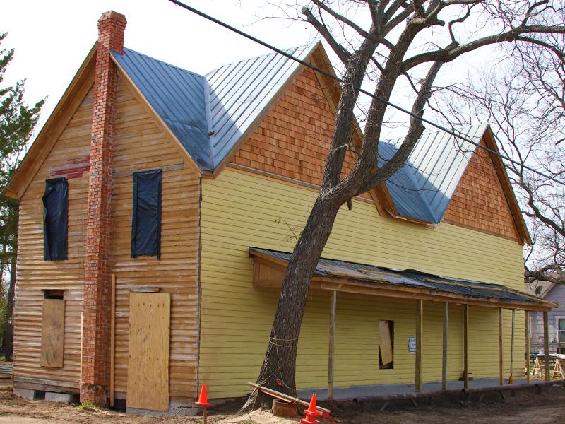
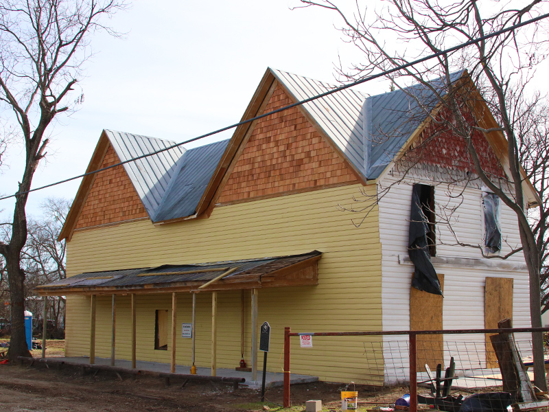
Brown Hotel
Colonel J.T. Brown founded the town of Chico in 1876; then built this hotel 1888.In a ceremony on the hotel porch, Governor Charles A. Culberson pardoned Brown for his part in an 1895 fight fatality.
Banker-tenant R. Lee Morris owned Brown Hotel from 1908 to 1965.
The Siddon-Barnes Log Cabins sits just behind the hotel on the same parcel of land. Here is how it appears today, along with the text on its historical marker.
Siddon-Barnes Log Cabin
Siddons-Barnes Log Cabin
This log cabin, believed to have been built in the early 1870s, was the first place of worship for area Methodists and served as a schoolhouse. Dr. J. A. Siddons and his wife M. E. Siddons purchased the cabin in 1883 and enclosed it with other rooms. In 1918 J. D. Barnes and Rachel Perkins Barnes bought the property. The rooms surrounding the original log cabin were removed in the 1970s. It was moved to this site in 1987, and the fireplace stones were restored. The cabin features half-notched rough hewn oak logs, an interior loft, and measures 256 square feet.
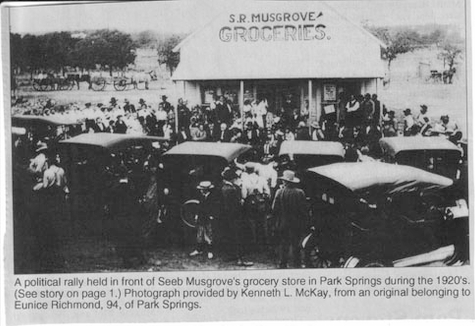
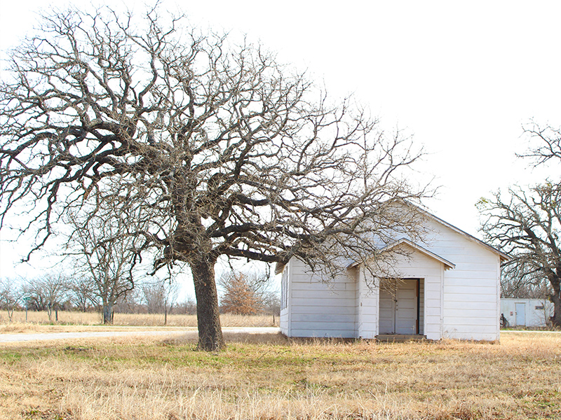
Now it was time to get back on TX 101 and continue north–this time to a place known as Park Springs.
I was really looking forward to this stop. You see, in the early days of this blog, one of the first articles I wrote was about Ghost Towns in North Texas. That entry was about two forgotten townships located in Denton County–Stony and Drop. Shortly after posting the article about those two ghost towns, a reader sent me an email recommending that I should check out a third–this one in Wise County. You guessed it–Park Springs is that ghost town.
This is how the Texas State Historical Association describes the little community of Park Springs…
Park Springs, Texas
Park Springs is on State Highway 101 two miles south of the Montague county line in the northwest corner of Wise County. It was originally known as Pringle but was renamed for a nearby grove surrounded by springs. Settlement of the area began in the early 1890s. A post office was established in 1893 with Margaret C. Evans as postmistress. The catalyst for the development of Park Springs was the arrival of the Rock Island Railroad. By 1900 the town had a population estimated at 400, three grocery stores, a bank, a feed store, an ice house, a blacksmith, an eleven-grade public school, and a hotel. The Park Springs hotel became the center of the town’s social activity. By the end of World War I Park Springs was declining steadily. In 1915 postal service ended. The school was discontinued in 1944, and by the mid-1940s the population had dropped to 250. By 1964 Park Springs had an estimated 100 residents. It was still listed as a community in 1990.
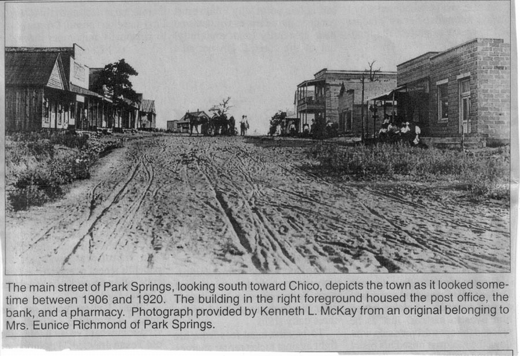
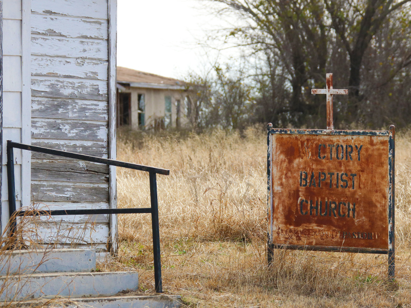
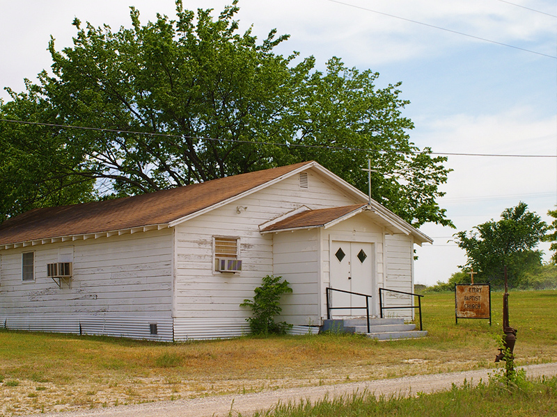
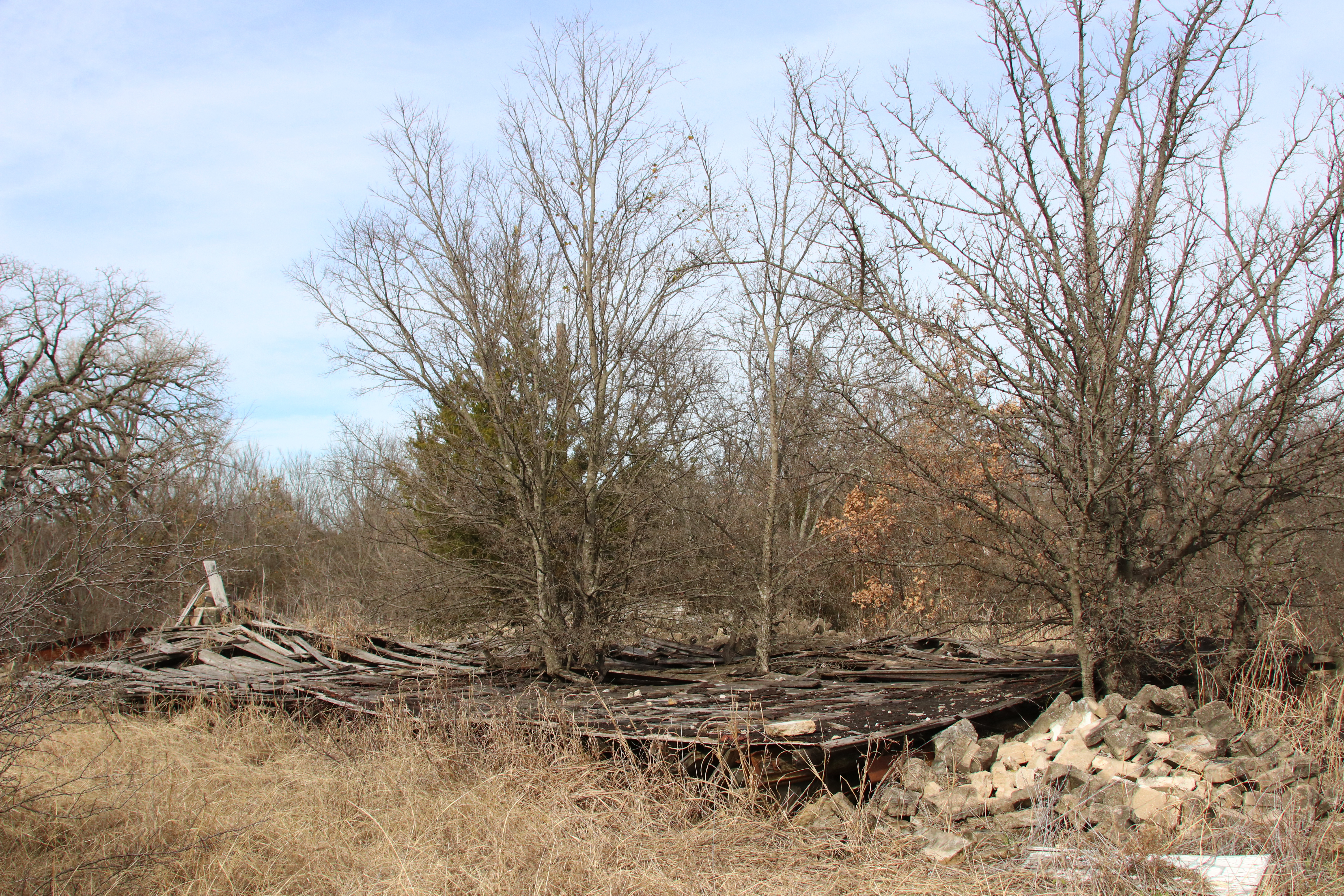
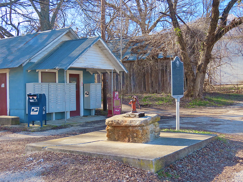
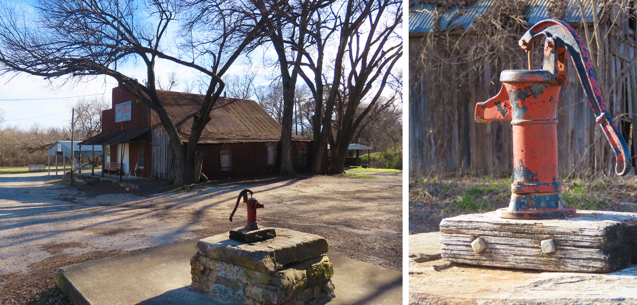
Today there is not much left in Park Springs. The old general store is holding on, but certainly losing its battle with time and the elements. The bank building next to it has collapsed into a pile of rubble, leaving only a pair of mailboxes behind. The old Victory Church just across the street has been abandoned–the congregation having moved to a newer building on the highway just south of town.


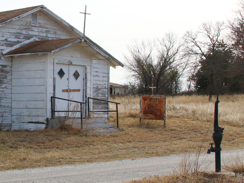
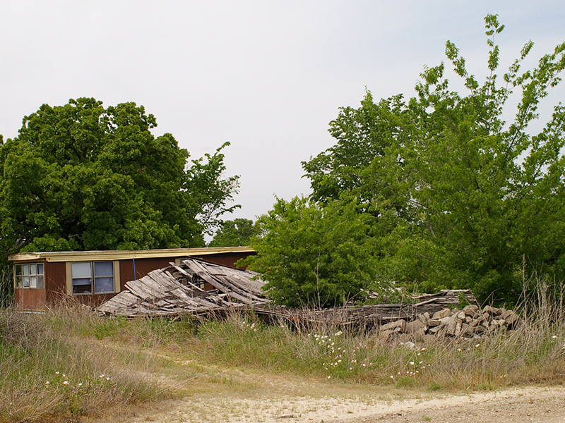
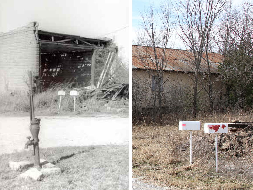
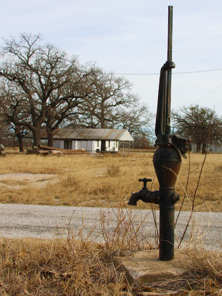
To me the most iconic part of this little ghost town is the old water well hand-pump sitting right in the middle of the main drag. Certainly a throwback to a much earlier time.
Even at its height, Park Springs never had more than about 400 residents. As fortune turned and the population began to drop through mid-century, the town went into a decline from which it would not recover.
There are many abandoned homes found along the old city streets. Most are in an advance state of deterioration. But, there are also a few occupied homes left around the old township. Many, if not all, sported prominent “Trespassers will be shot” signage. We took these messages at their word, and steered well clear.


Our next stop was the small town of Alvord, TX, located on highway US 287, east of Park Springs and about 10 miles north of Decatur. There were a couple of things we wanted to see while we were here, and another extended drive through the Wise County countryside would be required to get there. There was still snow on the ground at a few places we passed…


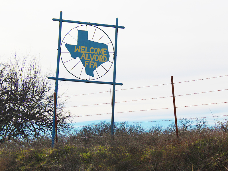
Arriving at Alvord, it did not take us long to find the first waypoint we were looking for. The building in the pictures below is located on the old BUS 81 highway–one of the town’s main thoroughfares. It appears to be similar in concept to the Texas Tourist Camp Compound in Decatur. From the looks of things the building has undergone a partial renovation since the last time we were here.
Just south of Alvord on Old Decatur Road is a spot that we visited 14 years ago. I don’t recall exactly what inspired us to stop here way back in 2005, but something did. That’s when I took this picture of my daughter, who was about 7 years old at the time.

My daughter and I discussed attempting to recreate this shot on this trip through Wise County, but we couldn’t quite remember where we were when we took the original picture–I wasn’t even sure if it was in Alvord or somewhere else in the county. It had been too long!
But as we drove out of town on Old Decatur Road things started to look more and more familiar. We both recognized the right place at roughly the same time, and I quickly pulled over. There I took this new photo my daughter, who is now 21 years old.

From this spot on the railroad tracks, we traveled roughly a mile further down Old Decatur Road to another important historical marker. This marker is located in a small cemetery and notes the general site of the tragic Huff family massacre.
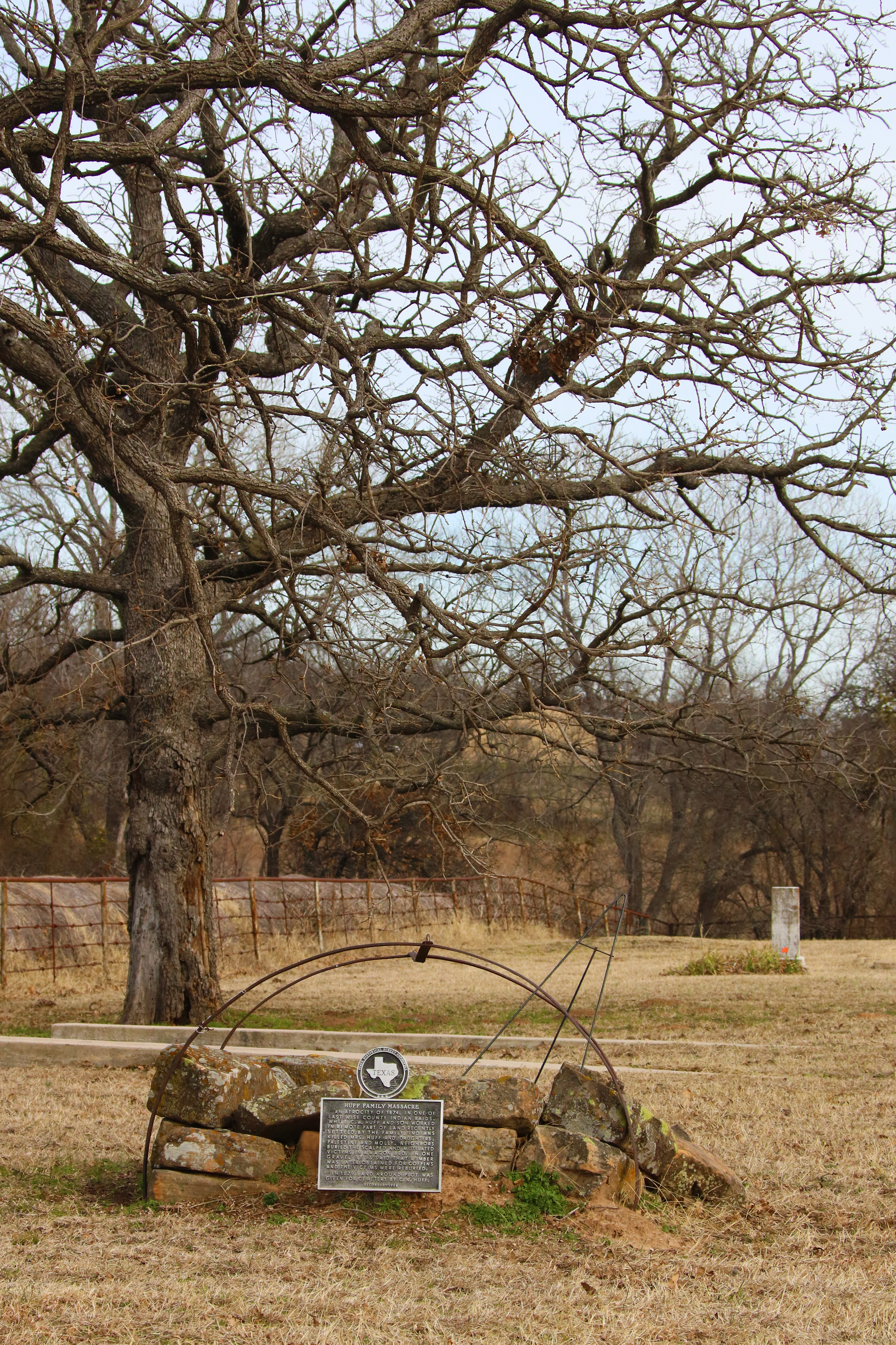
Huff Family Massacre
An atrocity of 1874, in one of last Wise County Indian raids. While C. W. Huff and son worked in remote part of land recently settled by the family, Indians killed Mrs. Huff and daughters, Palestine and Molly. Neighbors buried the scalped and mutilated victims in a wagon bed, in the grave. It is said that lumber was later obtained for coffins and the victims were reburied. In 1879 land around plot was given for cemetery by C. W. Huff.
I believe the arches over the grave in the picture above are the original metal supports for the cover of the wagon the women were buried in. You can read a full accounting of the Huff Family Massacre as published in the Wise County Messenger by clicking here… Huff Massacre a Sad Note in Wise County History.
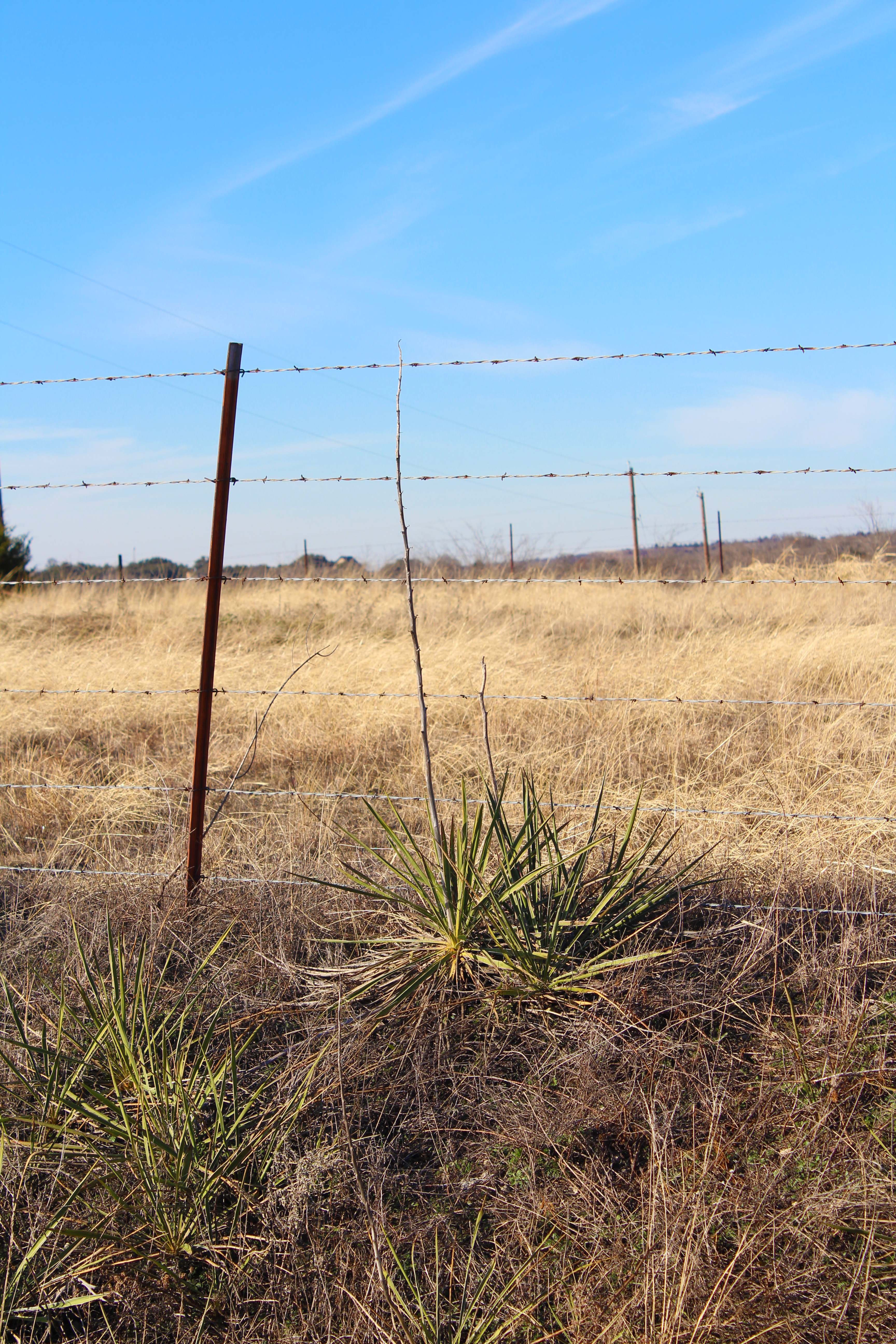
Back on the road again we now entered the LBJ National Grasslands. The grasslands are a patchwork of public land running through the northwest portion of Wise County. These rolling landscapes were purchased by the federal government during the Great Depression in order to correct years of overgrazing and other abuses. Originally known as the Cross Timbers National Grasslands, the park was renamed for Lyndon B. Johnson in the early 1970’s

Administered by the USDA Forest Service, the grasslands are made up of over 20,000 acres of varied terrain. Crosstimbers woods and open prairie, dotted with small lakes and ponds, and crisscrossed with soft, loamy horse and hiking trails. In some places there are stands of pine trees, somewhat out of place this far west, but beautiful to experience nonetheless. Wildlife abounds in this park, and we observed several different species even though we were passing through quickly.
Our primary objective in the grasslands was to have a look at the historical marker for the lost township of Audubon. Named for the famed naturalist, John Audubon, the town began to falter when it was bypassed by the railroads in 1883. All that remains today is this historical marker, and the Audubon Church–so name to commemorate the lost community.
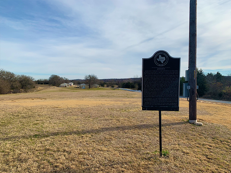
Audubon
A vanished town which was important in this area in the 19th century. It was settled by southerners and named for naturalist John J. Audubon (1785-1851).Earliest settler, D. D. Shirey, platted town out of his farm land in 1865. He and his wife, “Aunt Polly”, expanded their log house into a stagecoach inn that grew famous for a lavish table. Their excellent food was set out on a lazy Susan, which was the wonder of the countryside. In the late 1860s and following decades, trail crews detoured from the cattle trail that ran to the east of here and bought supplies in the town. Audubon had a post office from June 25, 1874, to July 20, 1904. Local social and fraternal bodies included Woodmen of the World and a Masonic Lodge active from 1879 to 1886. There were three churches, a school, a telephone office, two cotton gins, several mercantile stores, several lawyers and physicians, and two blacksmiths. The noted Dr. W. B. Palmer, had a beautiful country home, “Gynndome”.
Bypassed by the Fort Worth & Denver Railroad in 1883, Audubon gradually declined. Post office closed in 1904; school consolidated with Alvord in 1930.
Among outstanding native sons was the Reverend M. M. Barnett of the California Baptist Foundation.
On the far eastern corned of the grassland is the small borough of Greenwood. It would be our next stop as we made our way back to Decatur.
The drive to Greenwood treated us to more beautiful scenes of the North Texas crosstimbers, intermixed with fantastic ranches and cattle operations. Along the way we noticed this tombstone, oddly out of place just off the road and deep inside the grasslands. The tombstone was alone. There were no other grave markers in the immediate area. Just another example of the unusual and unique things to be discovered in Wise County.
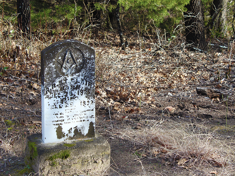
Here is the text from the headstone…
R.R. ST. CLAIR
Fold him oh! Father in thine arms
BORN
DEC 30, 1826
DIED
JUNE 29, 1892
And let him hence forth be
A messenger of love between
Our human hearts and thee
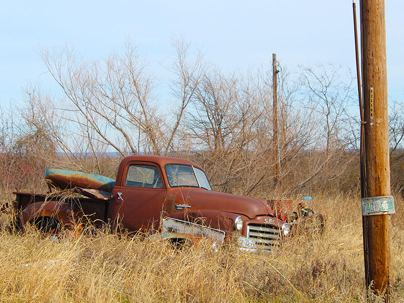
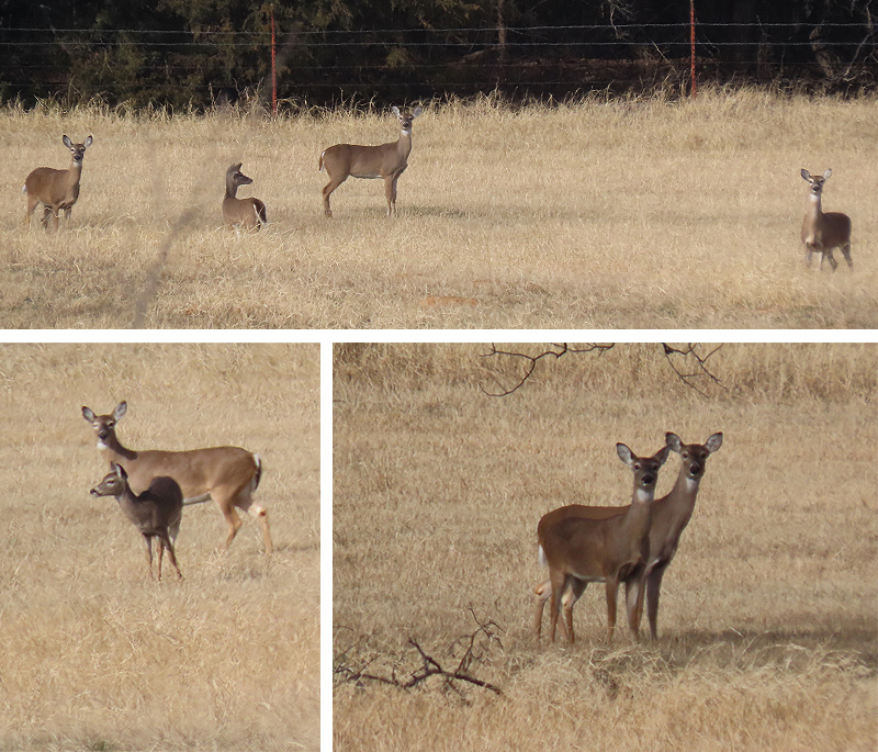
This was also the stretch of our drive when we observed the most Wise County wildlife. Below are a few examples…

We reached Greenwood in the mid-afternoon. The sun had reemerged from a brief period behind a haze of high clouds, and we were grateful for that, as the good lighting it provided would extend our picture taking time as the day wore on.
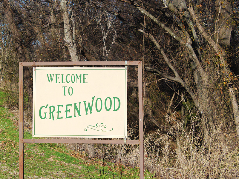
Greenwood
Pioneer settlers came to this area as early as the 1850s. Local tradition states that the Greenwood and Hart families were among the first settlers in the area, and that the community was named for the Greenwood family and the creek was named for the Hart family.As the town of Greenwood began to grow, businesses, churches, a cemetery, school, and Masonic Lodge were established. A post office was opened in 1877, and a town well was dug by John Karr Berry in the early 1890s. At its peak, the town boasted two saloons, four grocery stores, two drug stores, a hotel, bank, hardware store, barber shop, blacksmith shop, cotton gin, and the Greenwood Gazette newspaper. The Greenwood Male and Female College, although in operation for less than twenty years, provided quality education for young people of the community.
This small settlement has served as a supply center for surrounding farming communities for over one hundred years. It has also been a center of social and religious activities. Three churches serve the Greenwood area: Greenwood Baptist Church, founded as Hart’s Creek Missionary Baptist Church about 1872; Greenwood Methodist Church, founded about 1880; and Greenwood Church of Christ, founded in 1896.
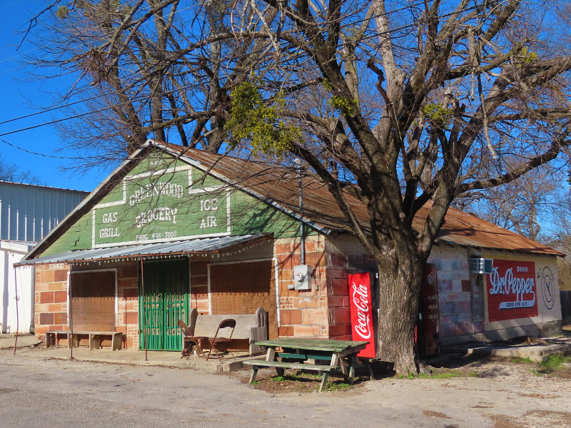

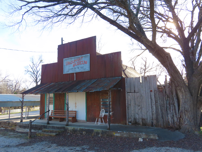
Urquhart Museum is a privately owned museum in Greenwood, Wise County, Texas. Was once a general store owned and operated by C.O. and Eva Urquhart. The museum is open to the public only during times of local community events – from the museum’s Facebook Page
We were starting to think about heading home at this point, but we had one more stop to make. The marker for the Battle of the Knobs is on the same Old Decatur Road as many of the others, but this one is located just north of Decatur.
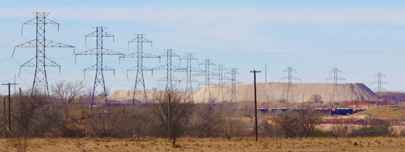
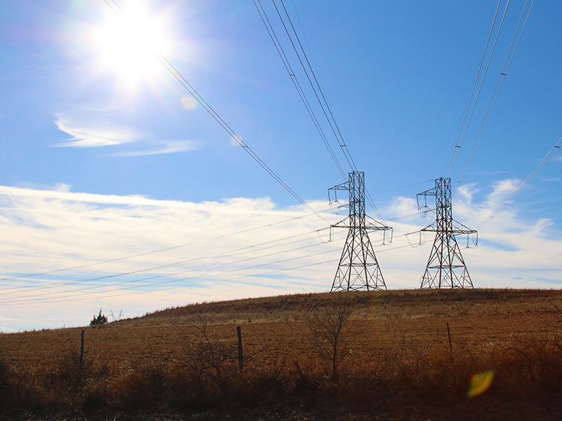
This is another site we visited back in 2004. It’s changed a little bit in the intervening years with the addition of a utility right away and its accompanying transmission towers. The interesting history associated with this location has not changed, however…
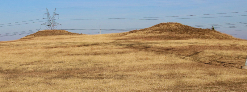
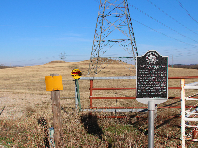
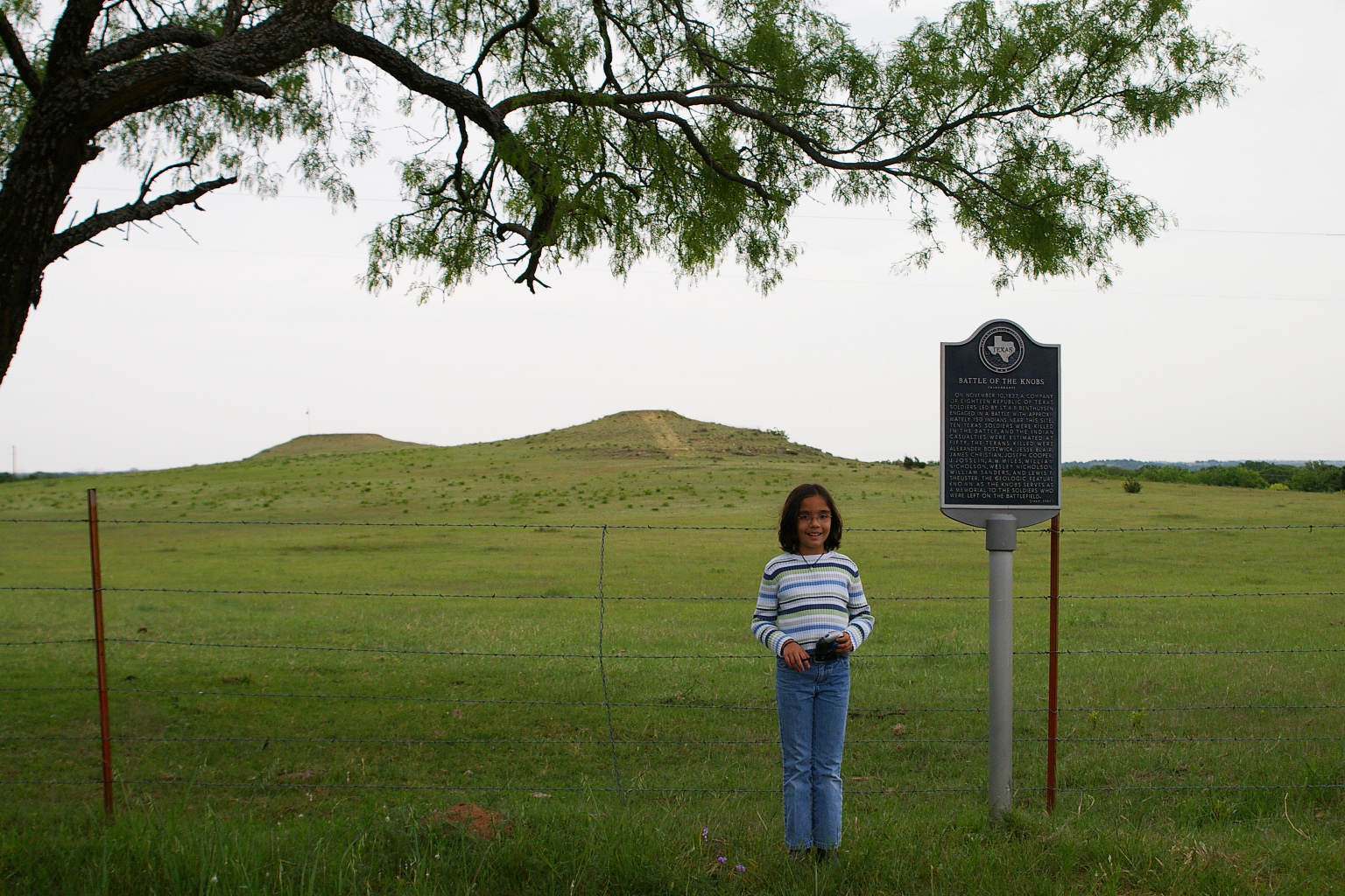
Battle of the Knobs
On November 10, 1837, a company of eighteen Republic of Texas soldiers led by Lt. A. B. Benthuysen engaged in a battle with approximately 150 Indians near this site. Ten Texas soldiers were killed in the battle, and the Indian casualties were estimated at fifty. The Texans killed were Alexander Bostwick, Jesse Blair, James Christian, Joseph Cooper, J. Josslin, A. H. Miles, William Nicholson, Wesley Nicholson, William Sanders, and Lewis F. Sheuster. The geologic feature known as the Knobs serves as a memorial to the soldiers who were left on the battlefield.
The Battle of the Knobs would be our last stop of the day. We had covered a lot of ground over the course of about 8 hours on the road, and we saw many interesting sights. But it was time to head home now, and back to the 21st century, just across the county line. Back to the Future. No flux capacitor needed.


Thanks for the great write-up. I moved to Wise County from the DFW area last year and have been enjoying learning the history of the area. You’ve given me a great list to explore. I just found the Babb site yesterday, a few miles from my house. So many interesting things!
Was wondering about Decatur ice house
I have an artifact from it