

Dateline – February 2, 2013
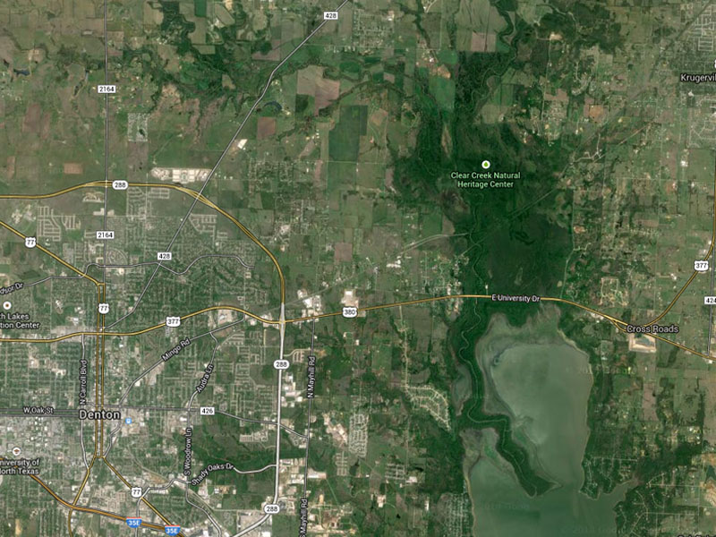
On Google Maps the lands north of Lewisville Lake all the way up to Lake Ray Roberts appears to be one of the most expansive and remote wilderness areas in the metroplex.
I have long been intrigued by the possibilities of what might be hidden in these swamps, bogs and bottomlands. This area is different from the Great Trinity Forest in south Dallas. It is not a place that a city has forgotten, it is instead a place that has never seen extensive development. It has long been an untamed wilderness. Surely, this place is home to some of the area’s most exotic urban wildlife.
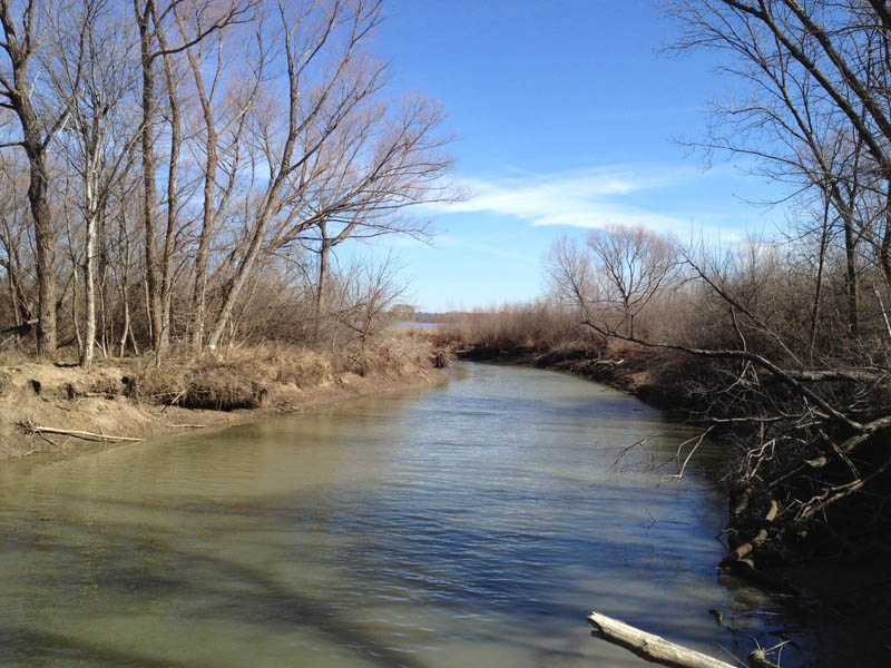
When viewed from Google Maps there are a number of locations that call out for exploration. One of the most compelling is a narrow spit of land that juts out into Lewisville Lake starting at US Highway 380 and continuing south for over 3 mi/6 km. The Elm Fork of the Trinity River flows through the center of this peninsula until it empties out into the middle of nowhere.
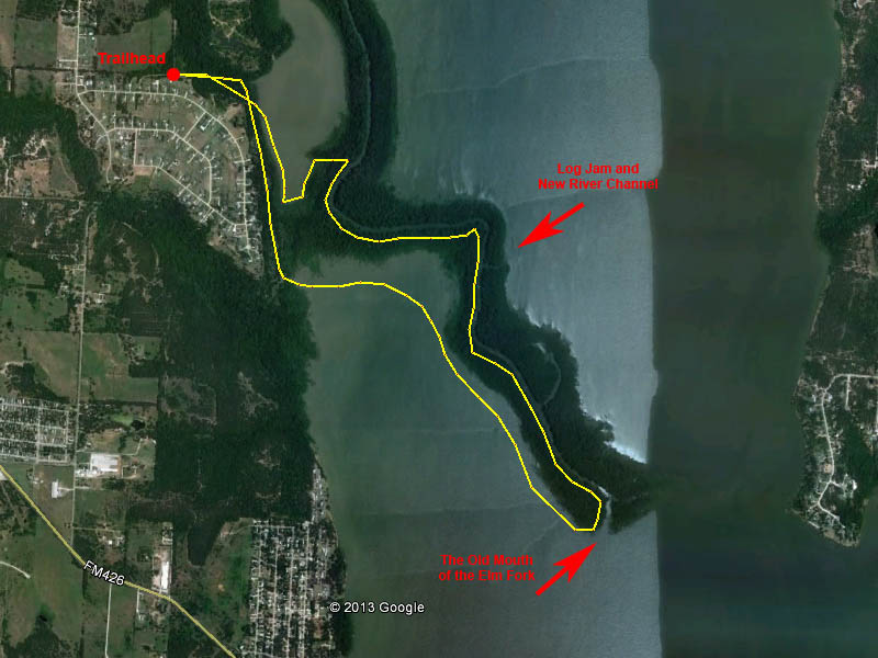
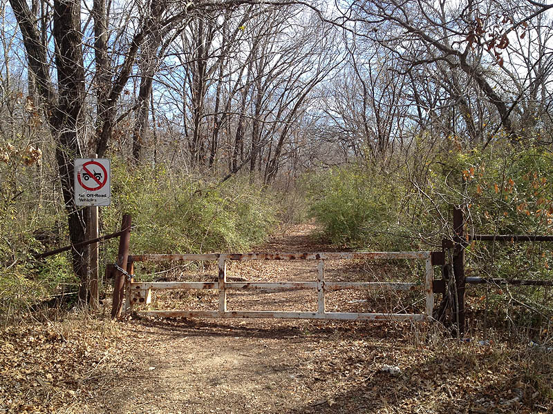
I chose this area as the place for my first foray into the wilderness surrounding the central Elm Fork. With a little pre-expedition scouting I identified a spot near the end of North Trinity Road as the best place to gain access to the key sliver of Corps of Engineers land. A well established trailhead there provided a great place to begin my hike. I had no idea what I would encounter as I made my way deeper into the woods.
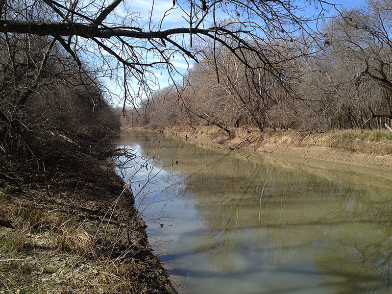
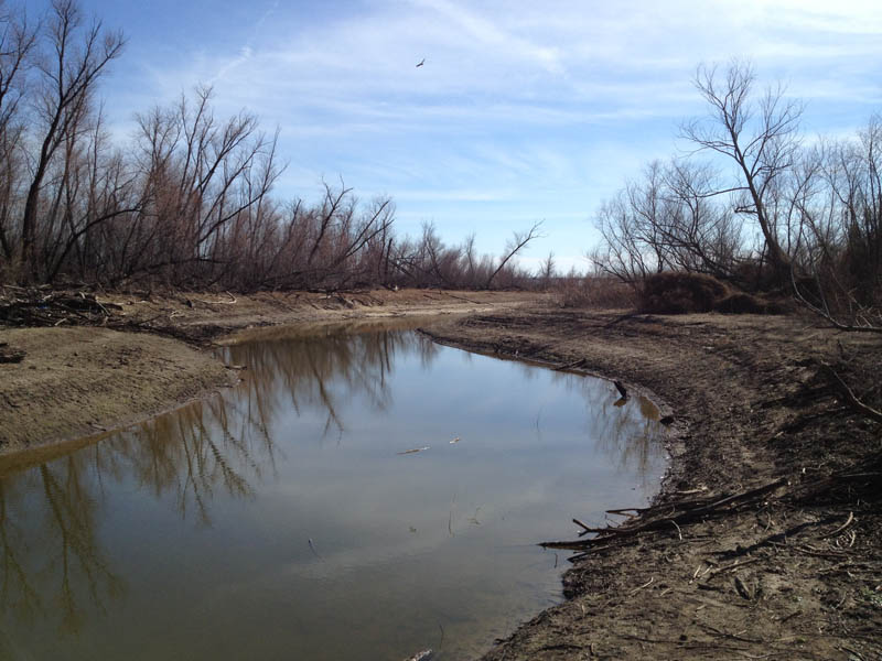
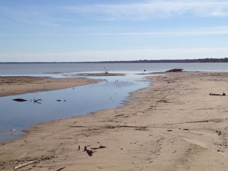
The first stop on the trip was a small, unnamed lake located between the river to the east and the trailhead to the west. This lake undoubtedly merges with the waters of Lewisville Lake when the reservoir is overfull, but at the moment the it is its own entity.
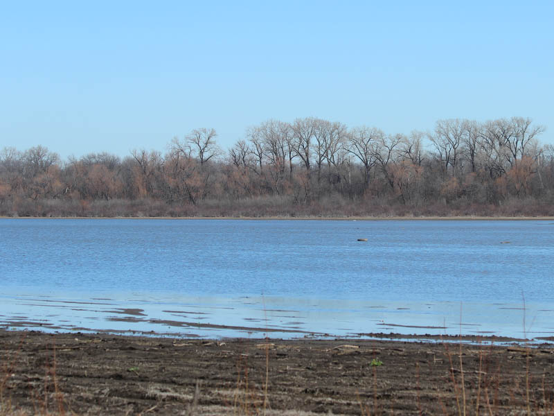
In its current state—shrunken by drought—the lake presents itself in a way that reminds me of Lemmon Lake in the Great Trinity Forest. It is surrounded by a ring of woods and dense vegetation. It appears to be shallow, and it clearly contracts and expands significantly on a seasonal basis.
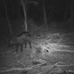
But, the likeness is not perfect. The most striking difference was the surprising absence of wildlife. We flushed no waterfowl as we approached the shore, because there were none on the water of this small lake.
As it turns out, the Corps of Engineers have set aside the northern end of Lewisville Lake as a public hunting area. The land here is open to hunting year round and this may account for the dearth wildlife. The shame of it is that there is no telling what kind of creatures would call this place home if it weren’t for the constant hunting pressure.
Continuing on, we made our way along the dry southern end of the lake looking for a promising spot to enter the woods in order to reach the river. As we made our way we heard hog-dog hunters working the river to the northeast.
Hunting hogs with bows is permitted on this property, but it is not clear if the brutal act of hog-dog hunting is allowed. I could find no verbiage addressing hunting dogs in the online literature. Unfortunately, this may be a classic case of the few ruining things for the many, once again.
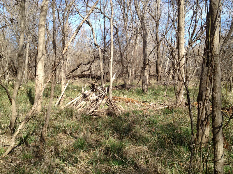
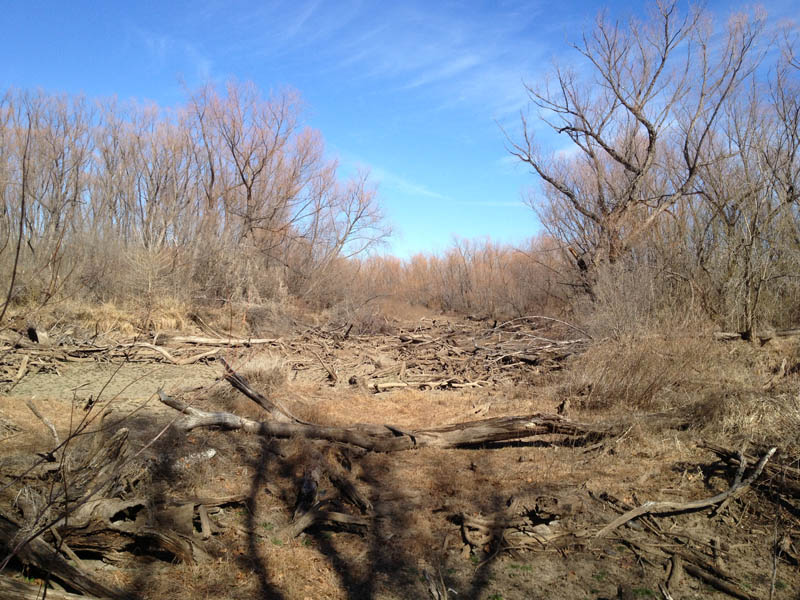
Some bushwhacking was required to penetrate the vegetation around the lake’s perimeter, but eventually we picked up a game trail that we could follow to the Trinity. Once under the canopy of the bottomlands the underbrush thinned significantly and the path became much easier to traverse.
Evidence of human activities continued to increase at this point as well. This was not the remote wilderness I expected it to be. Instead, we found a series of well worn footpaths and a number of recent campsites. A mile down the river we encountered a group of geocachers scouring the far side of the river for treasure. We conducted a brief conversation by yelling back and forth across the water. Nice guys.
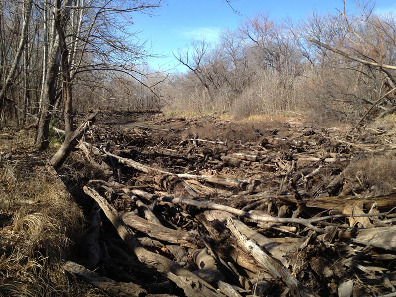
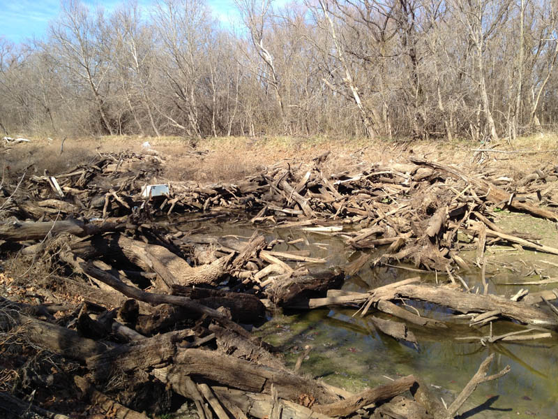
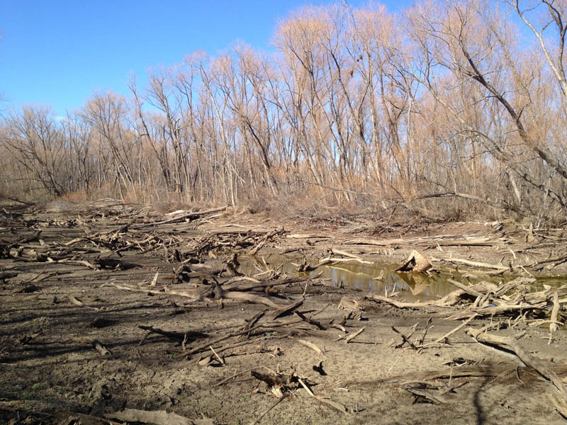
Afterwards we continued south to our first big surprise. At some point in the recent past a log jam had dammed the river and diverted it directly into Lewisville Lake a few hundred yards/meters to the east. This left nearly a mile of original riverbed without a water source. Google Earth shows that this river-reconfiguring obstacle formed sometime between 2007 and 2008.
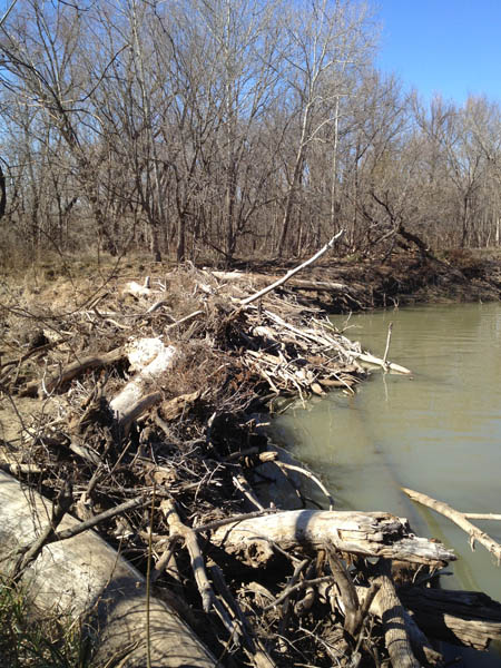
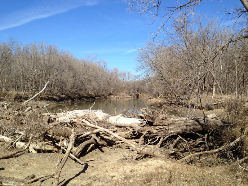
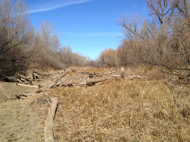
Traversing the dried riverbed was considerably easier than walking through the adjacent woods for the most part, and we used it where we could to speed up progress. But, in some places the old river channel became so littered with snags, branches, and tree trunks that it was virtually impassable. We often headed back under the trees to bypass these surreal landscapes.
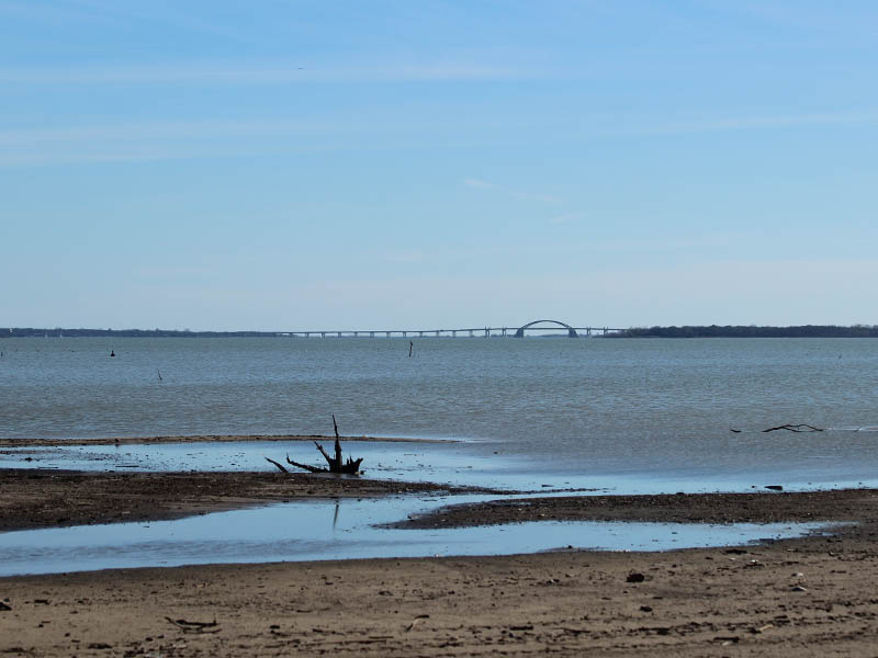
After another mile of this we finally arrived at the old mouth of the Elm Fork. This was our destination for the day. The view here was fascinating, offering us a look at a boat-free Lewisville Lake all the way down to the new toll bridge connecting Interstate 35 with the Dallas North Tollway via Eldorado Parkway.
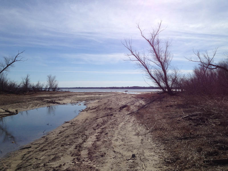
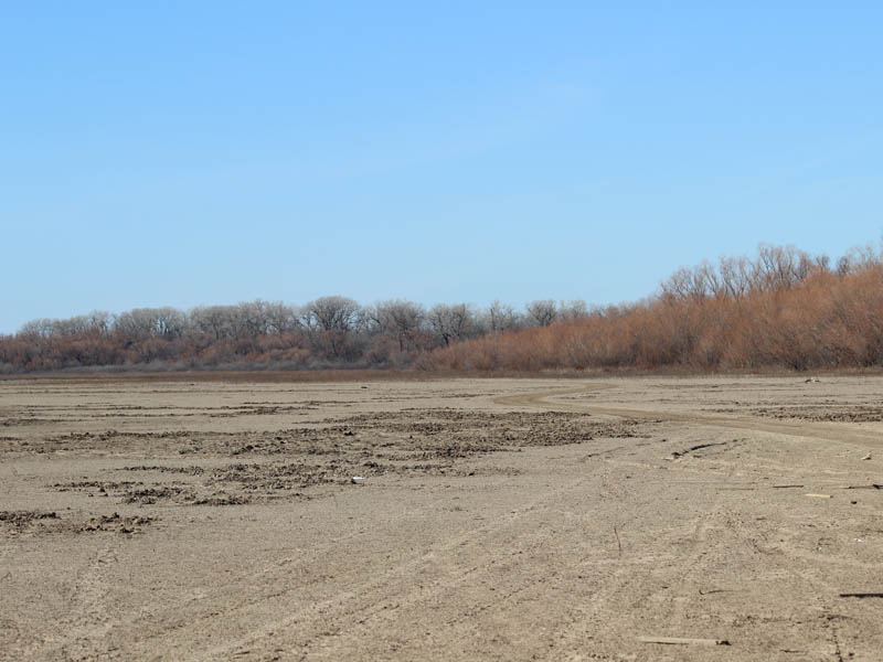
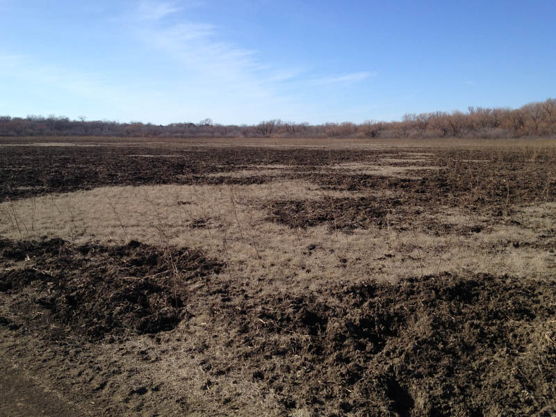
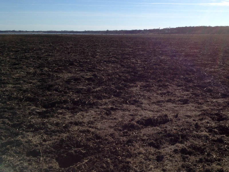
It’s been a long hard drought in North Texas, and here at the north end of Lewisville Lake we found the water had retreated to expose acres and acres of barren lake bed. This provided us with an easy route back to where we began our hike, and we took advantage of it. We were so worn out from the rough terrain that we were glad to have a flat, clear path for a change.
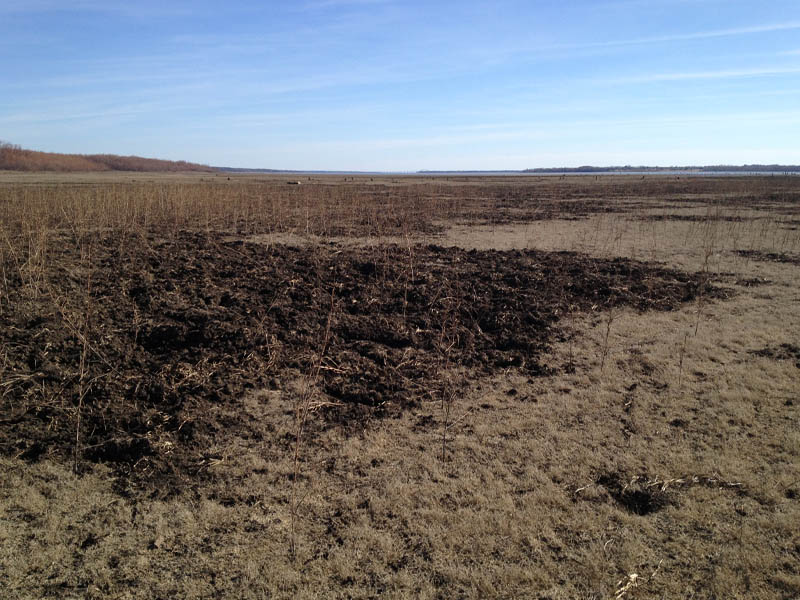
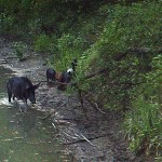
Along the way back, we came across some of the most remarkable evidence of Feral Hog activity that I have ever seen. Huge swaths of the dried lake bed had been turned over by the rooting of hungry pigs. It was quite a sight to see.
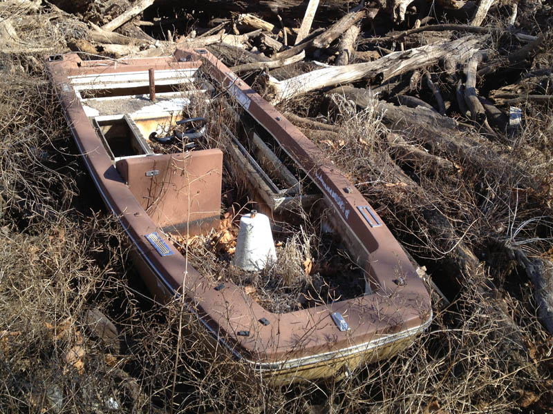
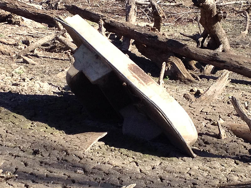
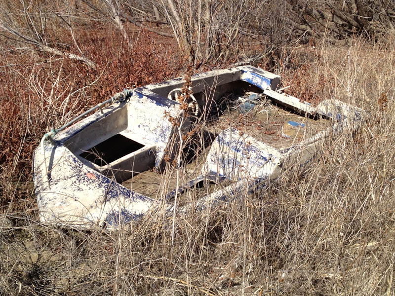
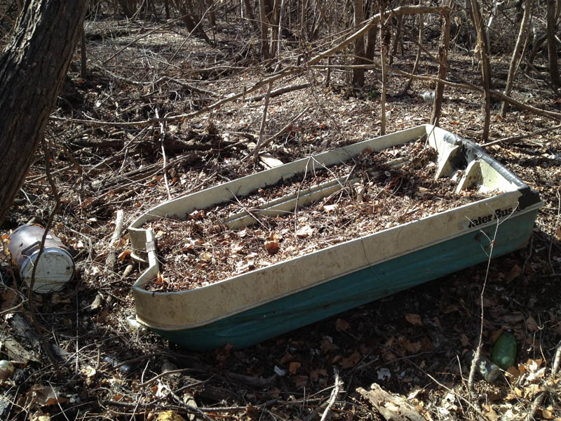
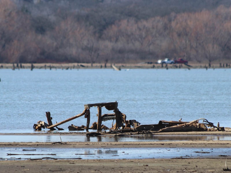
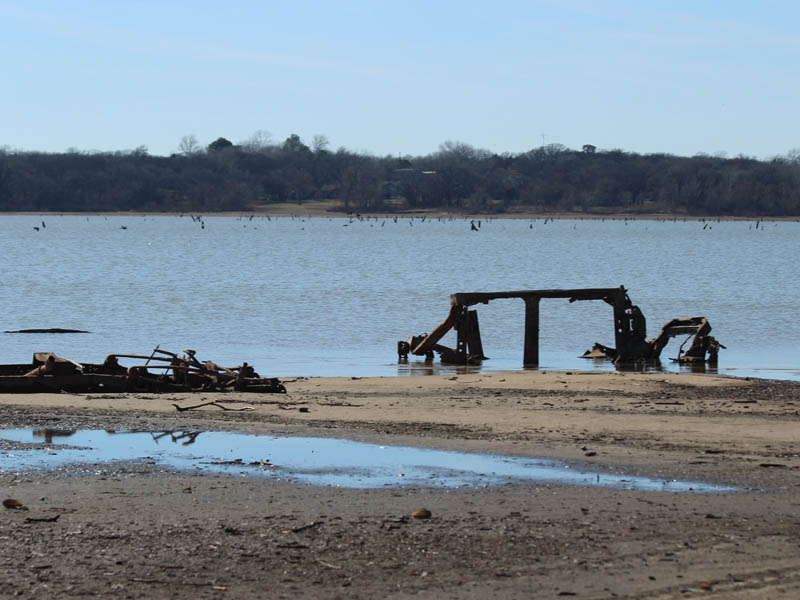
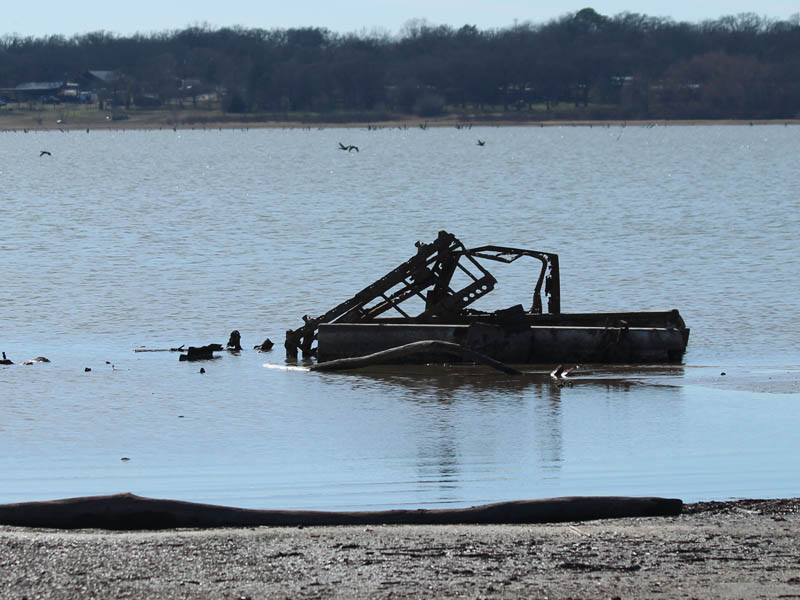
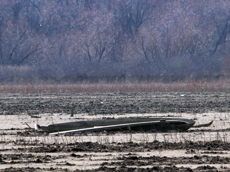
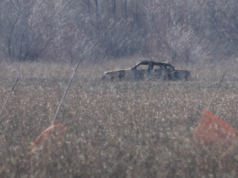
Hulks and Relics
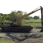
One of the most notable things we discovered on this trip was an interesting abundance of abandoned vehicles. Several boats and an automobile or two were found scattered about. No doubt stolen from their owners by the amoral waters of a flooded Trinity River.

Quite an interesting foray. During two different periods of my life I spent quite a lot of time in the Elm bottoms in the area you described: When I was in graduate school at North Texas in the sixties, and when I lived in Denton from 1989 to 1994. In both cases, the woods and river provided respite from hectic aspects of life. Feral hogs were still unknown in those bottoms in the 1960s, but a very few were starting to show up in the early nineties.
Some time around 1990 The Corps of Engineers and Texas Parks and Wildlife cooperated to build a graveled parking lot on the west side of the river at U.S. 360. The gate you showed in your first photo now prevents vehicles from driving into what was the lot. Prior to the lot construction, there was free access to vehicles as far as they could navigate downstream. The same year the lot was built there was a near record flood, with Lake Lewisville backing up all the way to and beyond Highway 360. The lot was under several feet of water, and when the water went down, there was no more parking lot. Then the gate was installed.
Thanks for posting the ramble. When I am down that way I may try to traverse some of that terrain again.
On rereading your post, I realized that you started from a more southerly location within the area we used to traverse. My comments regarding the former parking lot at U.S. 360 don’t apply to your hike. But, that also is an interesting place to start. I see on Google that the area is labeled “Fishtrap Park.” I do not believe there is any actually park development, but maybe the attempt to provide parking there was a part of the park. I hope it remains as inaccessible and undeveloped as it is now.
Vehicles are actually getting into the woods there… if you look next to North Trinity Road in Google Maps you will see a parcel of land that is completely cut up with trails. Off road vehicles enter here and are able to make their way down to the lake if the drivers are determined. There is also vehicle traffic coming up from the south. I’m not sure where their access point is, but they have established a good dirt road on the dry lake bed.
Anyhow, if you are inclined to, you should look me up next time you’re down this way. I’d love to discuss the then and now with you!
-Chris