Dateline – November 21, 2012

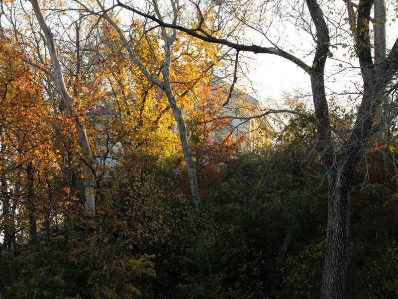
There are many fine points of interest to be seen in Dallas’ Great Trinity Forest. The list is long. There is the Buckeye Trail with its groves of namesake trees and flowers. There is the Trinity River Audubon Center, the heart of the Great Trinity Forest. There is the isolated and unique Lemmon Lake and the exotic fauna it attracts. There is the Lower Chain of Wetland Cells, a man-made mitigation designed for wildlife. There are many scenic overlooks and historical places. The list goes on and on.

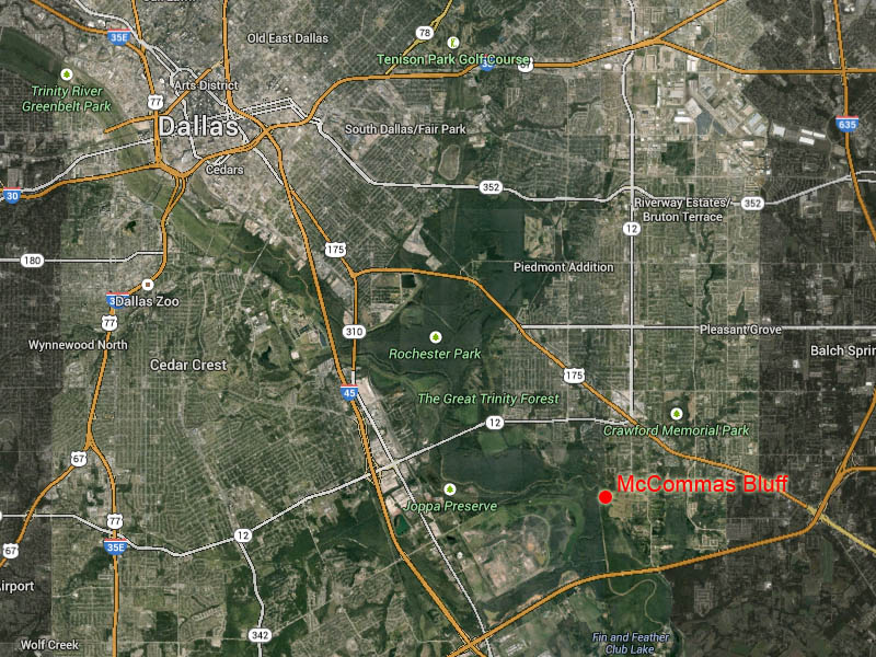
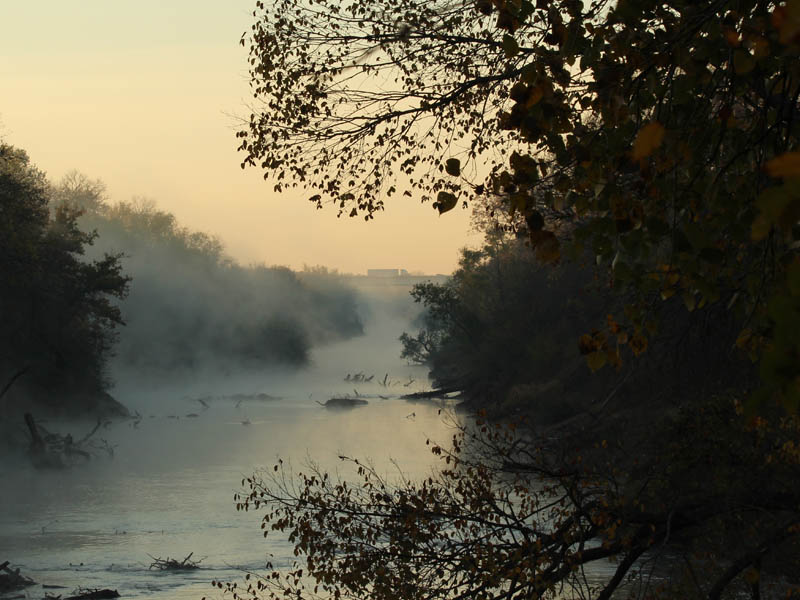
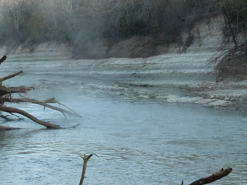
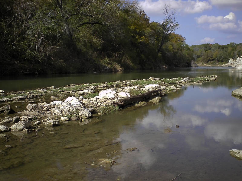
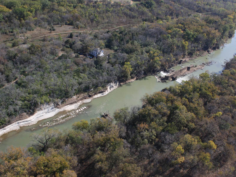
Of all of these places, perhaps the most special is McCommas Bluff. In addition to its striking natural beauty, there is a rich historical legacy associated with this spot on the map which makes it a particularly interesting place to visit.

Journal - McCommas

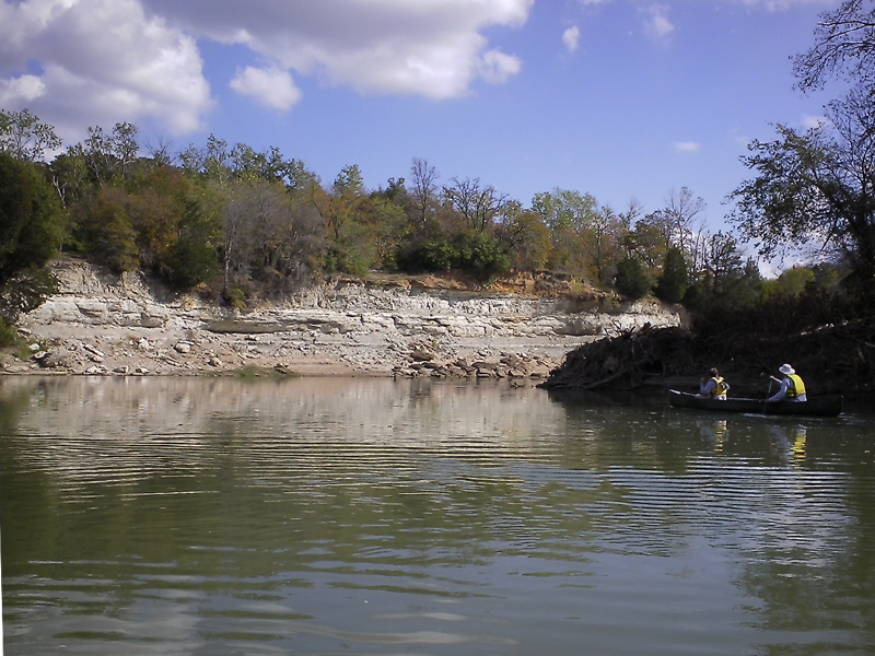
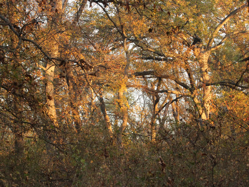
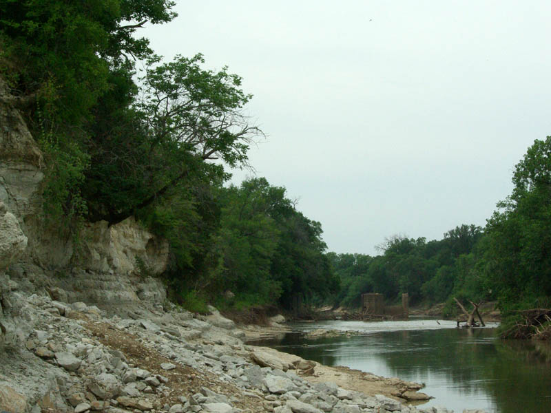
For centuries, the unusual and distinctive topography of McCommas Bluff has made it a natural meeting place. The white limestone cliffs are a unique geological feature in this part of the country. It is easy to imagine one person saying to another, “Meet me at the bluff,” in whatever dialect was prevalent at the time. Everyone involved would know exactly where to go.

The limestone cliffs of McCommas Bluff.
Approaching the Trinity River at dawn.
Approaching the Trinity River at dawn in the McCommas Bluff Preserve.
The City of Dallas is shoring up the river bank in an effort to protect a water main.
The City of Dallas is shoring up the river bank in an effort to protect a water main that runs near the bluff.
Early morning fog in The McCommas Bluff Preserve.
A dew covered spider-web.

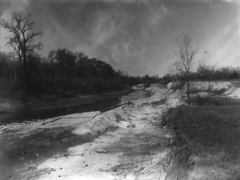
In the early days of Texas history this spot was the proposed location for Trinity City, a town expected to be the northern most port on a navigable Trinity River. But, Trinity City was never realized, most likely because navigating the Trinity was much more difficult than first hoped. The Trinity is a formidable river, especially as it approaches Dallas. Deceptive shallows, impenetrable snags, and dangerous shoals are all too common on the river. Considerable re-engineering would be required in order for it to accommodate barge traffic. Taming the river would be a challenge.

That did not stop people from trying. Over the years, a number of attempts have been made at creating a navigable Trinity River. Near Dallas, most of these attempts have centered on McCommas Bluff.

Sunrise through the dense woods.
Morning breaks in the Great Trinity Forest.
At the river, looking south.  That is I-20 far in the distance.
At the river, looking south. That is I-20 far in the distance.

One of the earliest efforts occurred in 1868 when Captain James H. McGarvey attempted to navigate the approximately 300 miles from Galveston to Dallas, with McCommas Bluff as the goal at this end of the map. He made it, but it took over a year to get there, and it was certainly a difficult and treacherous journey.

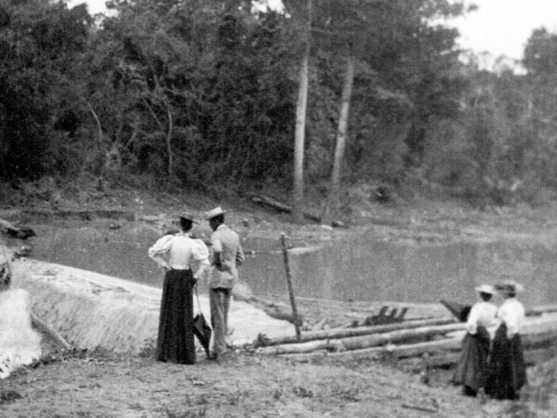
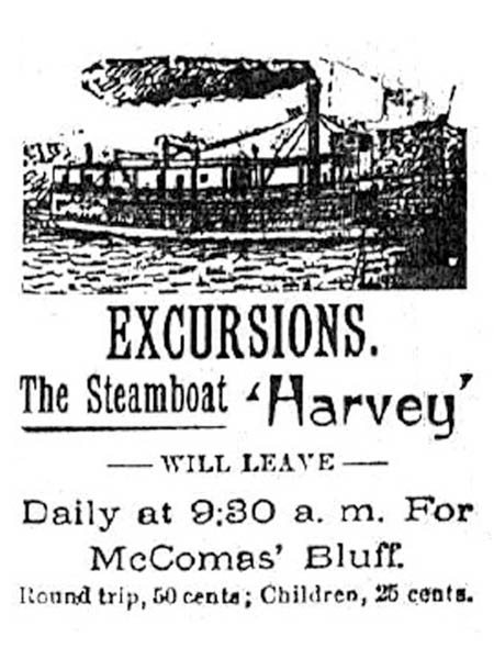
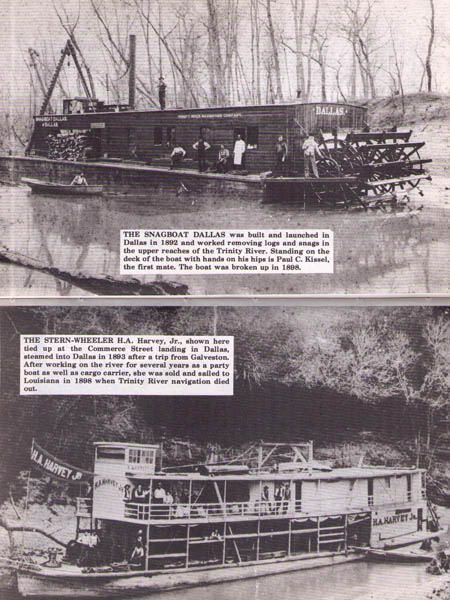
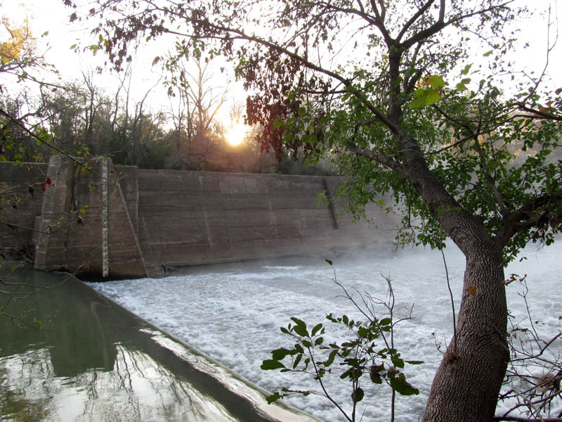
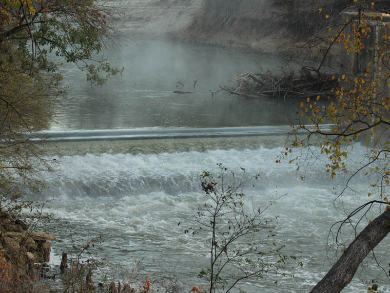
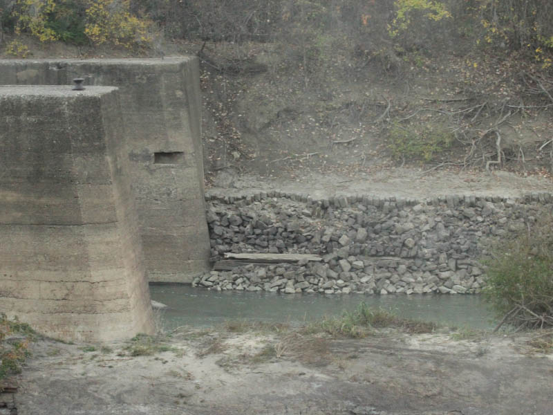
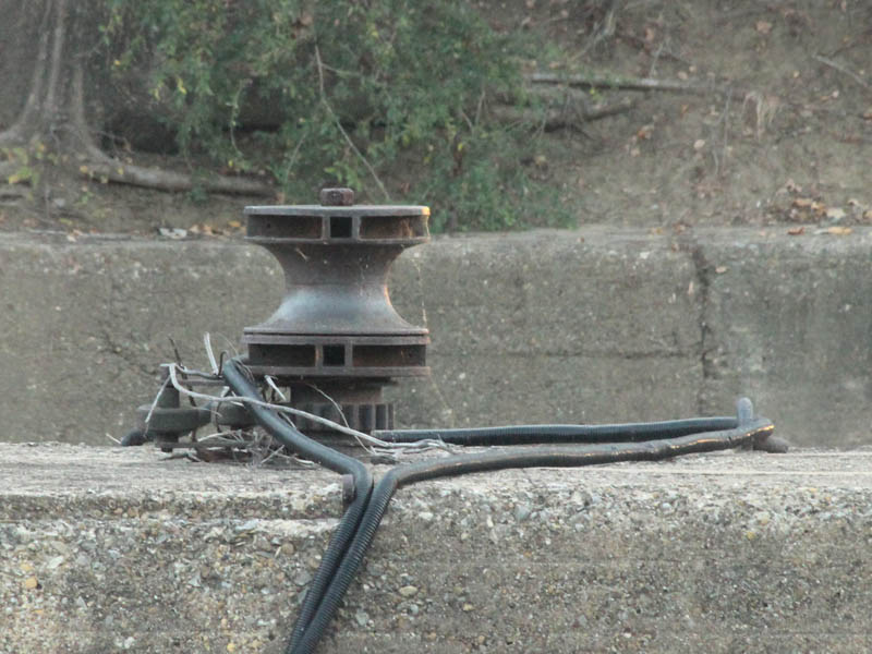
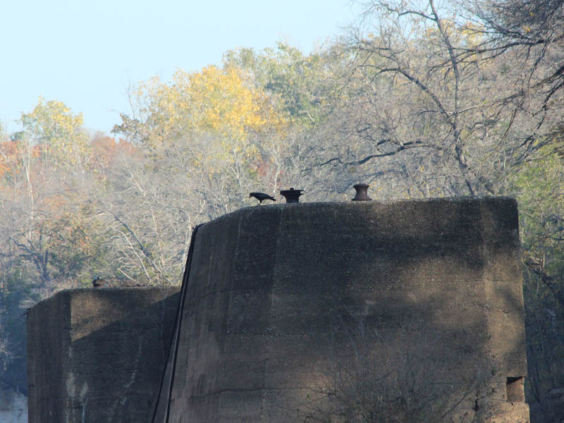
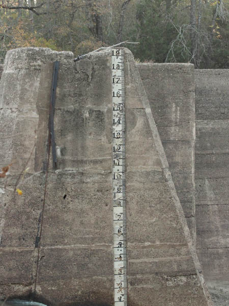
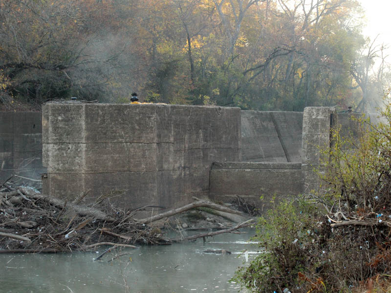
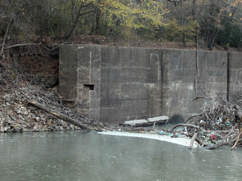
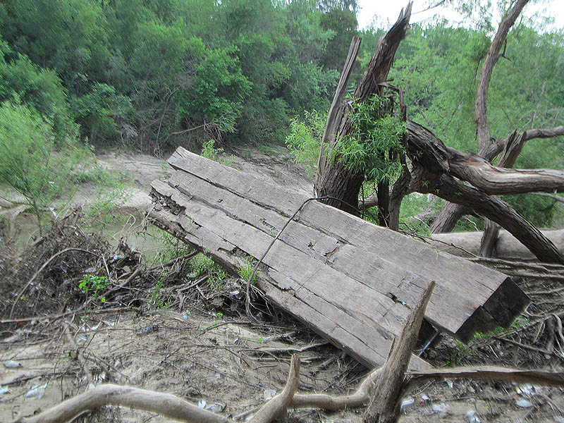
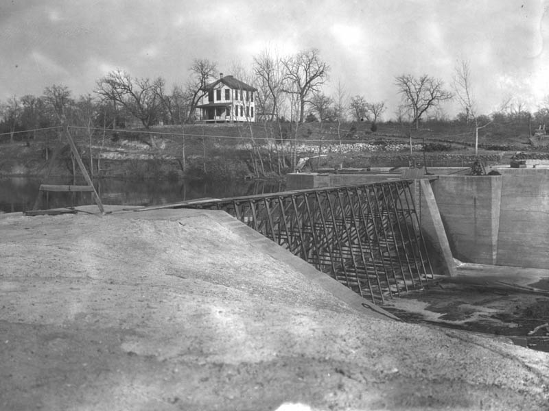
A few decades later, a primitive lock and dam was constructed at McCommas Bluff. This structure consisted of a timber framework filled with limestone boulders from the bluff. The purpose of this lock and dam was to facilitate steamboat travel back and forth from Commerce Street in downtown. For a time, the steamboat H.A. Harvey Jr. carried Dallasites to the dance pavilion and picnic area atop McCommas Bluff on a daily basis. The spot had its time as a popular destination, but eventually enthusiasm faded.

The 1893 lock and dam.
Dallasites enjoying recreation atop McCommas Bluff in the late 1800s.
An advertisement for the steamboat H.A. Harvey Jr.
Snagboat Dallas worked to keep the Trinity clear for steamships like the H.A. Harvey Jr.
Snagboat Dallas worked to keep the Trinity clear for steamboats like the H.A. Harvey Jr.
The remnants of the 1893 lock and dam today.
Some of the original timbers are still in place.
Another look at the remains of the 1893 lock and dam.  Notice the iron rods still in place after all these years.
Another look at the remains of the 1893 lock and dam. Notice the iron rods still in place after all these years.

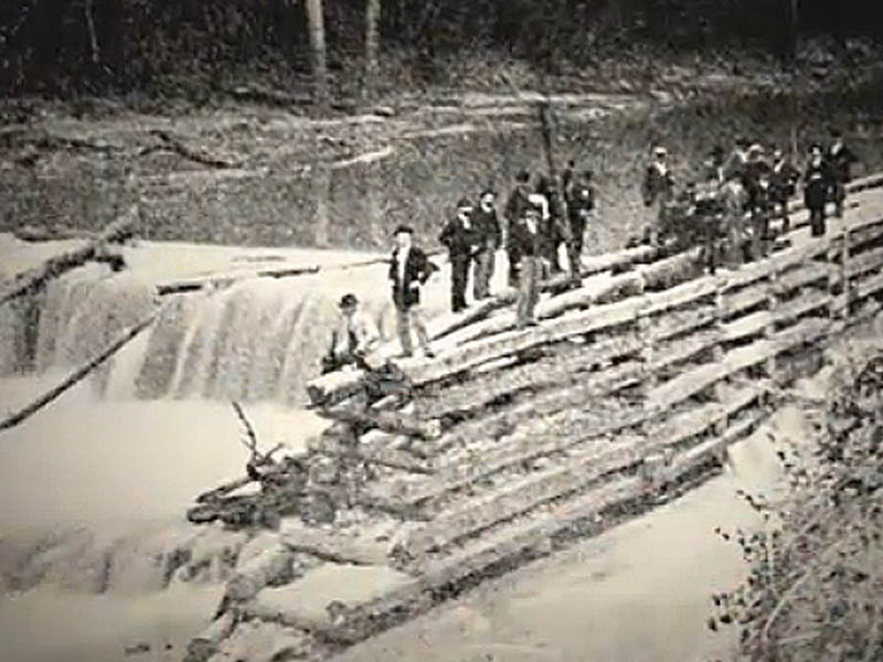
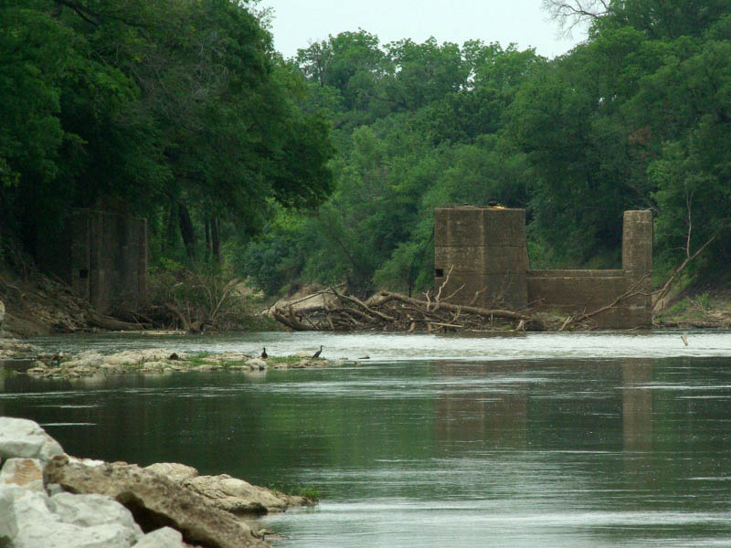
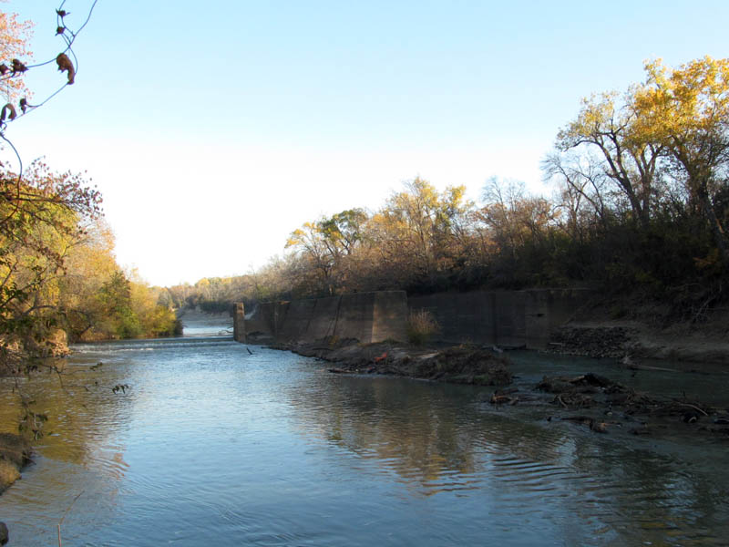
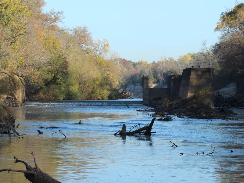
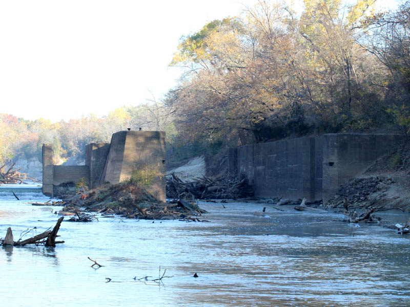
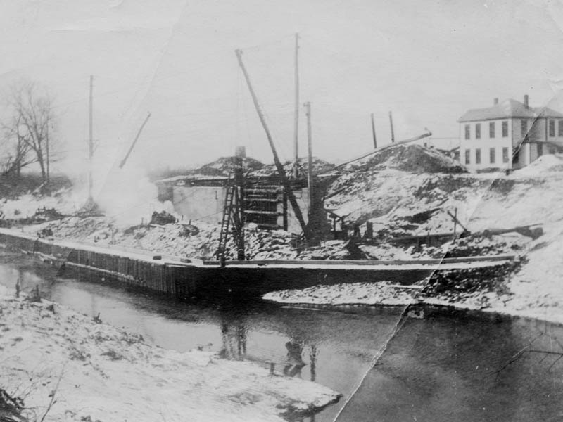
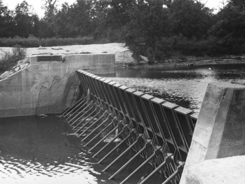
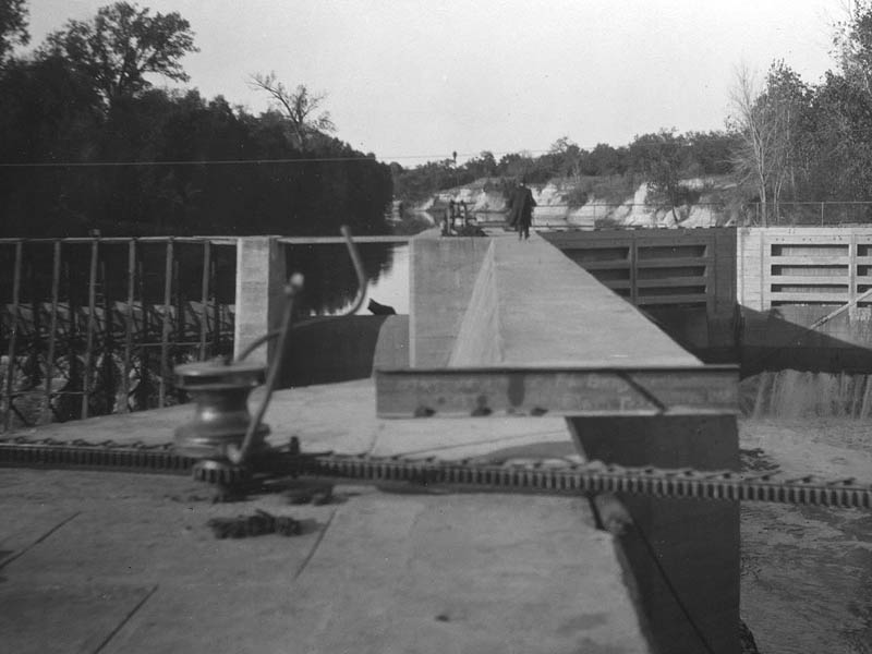
In the early years of the 20th century the desire to make the Trinity River navigable again began to be taken seriously. Between 1900 and 1921 the U.S. government spent around $2 million on Trinity River improvements. This work was to include the construction of a system of 37 lock and dams to be built on the Trinity River between Galveston and Dallas. Only seven were ever completed. The northern most, Lock and Dam Number One, was installed at McCommas Bluff.

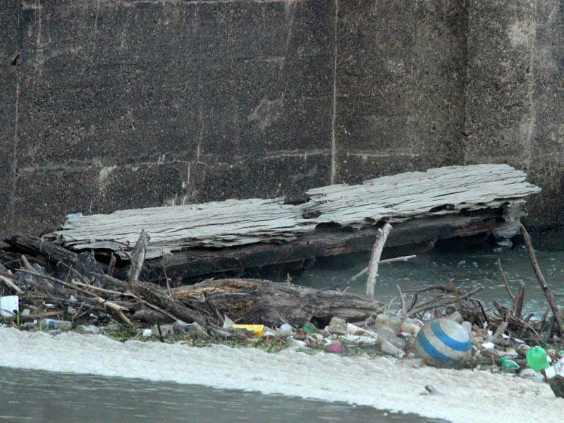
But, the barges never came. World War One changed the nation’s priorities, and the Lock and Dam project was abandoned. The few completed structures have sat in the river unused and neglected for nearly a century.

Somehow, the dreams of a navigable Trinity River still did not die. Efforts persisted well into the 1970s. Many of the bridges and overpasses constructed in the second half of 20th century were built with accommodating barge traffic in mind. Despite these steps, no one has been able to revive the momentum of earlier efforts.

The 1893 lock and dam and the 1916 Lock and Dam in context.
The remnants of the 1893 lock and dam and the ruins of the 1916 Lock and Dam Number One in context. That’s the old Lock Keeper’s House on top of the bluff.
Lock and Dam Number One as it appears from McCommas Bluff.
Notice the Double-crested Cormorants standing on the ruins of the 1893 lock and dam.
Notice the Double-crested Cormorants standing on the ruins of the 1893 lock and dam in the foreground.
This is Lock and Dam Number One as viewed from the south.
Water still flows over what remains of the dam.
The lock is regularly clogged with snags, dead-falls, and other debris.
The dam and the spillway.  Notice the depth gauge.  It is marked off up to 19 feet.
The dam and the spillway. Notice the depth gauge. It is marked off up to 19 feet.
Another look at the dam.  There are still concrete and iron structures in place under the water.
Another look at the dam. There are still concrete and iron structures in place under the water.
The south end of the lock.  Notice the collapsed stone work along the bank.
The south end of the lock. Notice the collapsed stone work along the bank.
This mechanism was involved in the opening and closing of the lock gates.
An American Crow, with a treasured acorn, standing atop Lock and Dam Number One.
The depth gauge located on the side of the spillway.
The spillway.
The spillway.
This recess received the lock gate when in the open position.  If you look closely, you can see the remnants of the wooden gate door at the bottom of the recess.
This recess received the lock gate when in the open position. If you look closely, you can see the remnants of the wooden gate door at the bottom of the recess.
A closer look at the remains of the lock gate.
A small plastic boat caught up in the debris collected around Lock and Dam Number One.
This picture was taken about 600 yards/meters further down stream.  These timbers were almost certainly once a part of Lock and Dam Number One.
This picture was taken about 600 yards/meters further down stream. These timbers were almost certainly once a part of Lock and Dam Number One.
The Lock Keeper's House today.
The Lock Keeper’s House today.
The Lock Keeper's house in 1916.
The Lock Keeper’s house in 1916.
Lock and Dam Number One under construction, circa 1916.
A historical photograph of the dam in operation.  This picture was taken in 1916.
A historical photograph of the dam in operation. This picture was taken in 1916.
In this 1916 photograph you can see the dam to the left, one of the lock gates to the right, and the lock gate drive mechanism in the foreground.
This is a picture of what the 1893 lock and dam looked like at the time of Lock and Dam Number One's construction in 1916.
This is a picture of what the 1893 lock and dam looked like at the time of Lock and Dam Number One’s construction in 1916.

Further Reading

4 Replies to “McCommas”

    1. I understand that the lock keepers house is occupied, and that the owner values his privacy! I believe that his property line runs right up to the river, which prevents an eastern approach to the lock.

      1. Went to the lock keepers house today. Broken down car and house falling apart, music playing in the house. What a wonderful house it must have been back in the day!

Leave a Reply to Douglas Cancel reply

Your email address will not be published. Required fields are marked *

This site uses Akismet to reduce spam. Learn how your comment data is processed.